Unfortunately for those tired of the rain and/or planning to head to New York City’s Times Square for New Year’s Eve festivities, another round of soaking rain is expected in time for the holiday. Rain could be heavy at times in the New York City area around midnight as revelers welcome in 2019. With a storm track moving west to near the Great Lakes, this holiday storm will produce primarily rain instead of snow.
Another area of low pressure, in a long line of low pressures to impact the Eastern U.S., will be responsible for the soaking rains. At the surface, high pressure is forecast to drift eastward
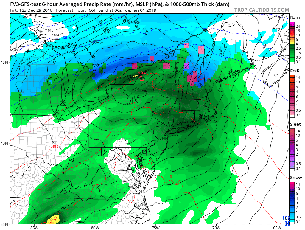
across the Mid Atlantic on Sunday bringing dry weather and near seasonable temperatures. On Monday, a ridge is forecast to build over the east on Monday, resulting in a trend toward milder temperatures and an increase in moisture. Low pressure is anticipated to move in from the Middle Mississippi River Valley on Monday, across the eastern Great Lakes on Monday night to New England and the Canadian Maritime Provinces on New Year’s Day. A moist and mild flow from the southeast to southwest is expected to develop for Monday and Monday night. Temperatures are expected to rise into the 40s and 50s on Monday with rain arriving from the west and southwest. The rain will likely continue into Monday night with temperatures rising a bit at that time. The rain may become heavy at times from late Monday afternoon into Monday evening, mainly across eastern Pennsylvania, northern and central New Jersey, Long Island, and the New York City metro area.
In it’s wake, the low is forecast to pull a cold front through the Northeast on Tuesday morning bringing and end to the precipitation. However, the cold air should lag a bit behind the front and mild temperatures are again in the forecast for New Year’s Day, especially in coastal areas.
High pressure should bring dry weather and a return to seasonable temperatures on Wednesday, keeping things temporarily dry for the start of 2019.
