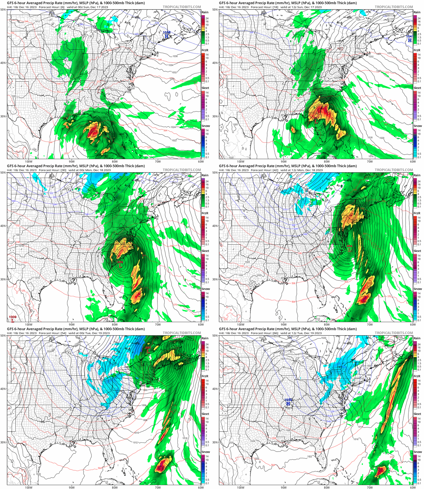
A nor’easter is on track to deliver very heavy rain, strong winds, and rough seas from Florida to Maine over the next several days. The storm system is gaining strength over Florida now where the worst of the weather will strike there tonight. Tomorrow, the nor’easter will begin to move up the east coast, arriving in the New York City metro area late tomorrow night into early Monday morning. Conditions will be too mild for snow; as such, rain is expected north through New England to the U.S./Canada border from this system. Coastal flooding and fresh water flooding could be a problem up and down the entire coast from Florida to Maine.
A low pressure system currently developing and expanding over the relatively warm waters of the Gulf of Mexico is forecast to interact with a surge of cold air mass from central Canada to deliver quite a stormy end to the week for the Eastern Seaboard.
Showers and thunderstorms ahead of this intensifying storm system have already been expanding steadily over much of Florida this Saturday afternoon. This is only a precursor of what is to come as the storm center is still located over the eastern Gulf of Mexico while gathering strength more rapidly.
East to northeasterly winds will further strengthen over all of Florida as the storm center is forecast to reach the west coast of the peninsula early Sunday morning. The wind shear ahead of the storm center could trigger a few tornadoes across the Florida peninsula tonight.

By Sunday, the low pressure center is forecast to skirt the Southeast U.S. coast, with the biggest threat of heavy rain up through the coastal plains as the day progresses with heavy thunderstorms possibly containing damaging winds and severe weather.
By Sunday night, the heavy rain should be tapering off over the Southeast while spreading up rapidly into the Mid-Atlantic states ahead of the storm center, with some strong thunderstorms possible.
The storm center will then track more quickly northward into New England on Monday while the entire system expands its influence across much of the eastern U.S. Wind-swept rain, heavy at times, will then overspread the entire Northeast during the day on Monday. Meanwhile, colder air from central Canada will be pulled southeastward across the Great Lakes on Monday behind the big storm, triggering lake-enhanced snow from west to east across the Great Lakes and toward the Appalachians by Monday evening as rain begins to taper off across the Mid-Atlantic. Even though the big storm will begin to depart the Northeast Monday evening, the huge circulation of the storm will overspread the entire eastern U.S. with very blustery conditions.
The storm center will then track more quickly northward into New England on Monday while the entire system expands its influence across much of the eastern U.S. Wind-swept rain, heavy at times, will then overspread the entire Northeast during the day on Monday. Meanwhile, colder air from central Canada will be pulled southeastward across the Great Lakes on Monday behind the big storm, triggering lake-enhanced snow from west to east across the Great Lakes and toward the Appalachians by Monday evening as rain begins to taper off across the Mid-Atlantic. Even though the big storm will begin to depart the Northeast Monday evening, the huge circulation of the storm will overspread the entire eastern U.S. with very blustery conditions.