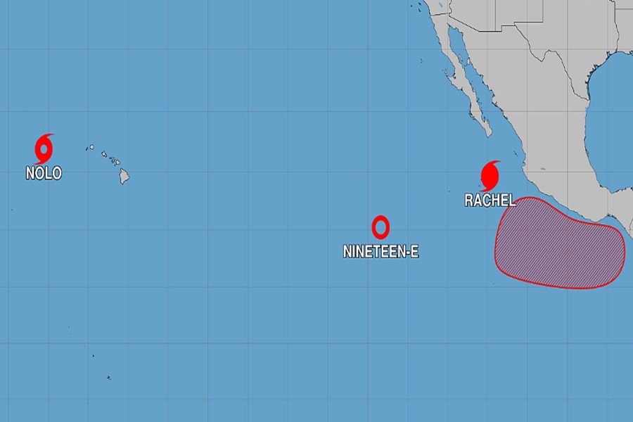
The Eastern Pacific Hurricane Basin remains hyperactive while the Atlantic Hurricane Basin is quiet, which has pretty much been the dominant pattern in the tropics this hurricane season. In recent days, Atlantic tropical storms Fay, Gonzalo, and Hanna formed and dissipated, leaving the basin without any storms. However, due in part to the El Nino phenomena, things remain especially active in the Pacific with Nolo moving away from Hawaii, Rachel heading away from Mexico, and a tropical depression, #19-E, fading away between them.
The National Hurricane Center is issuing advisories on Tropical Storm Nolo, located several hundred miles west of Lihue, Hawaii, on Hurricane Rachel, located about a couple of hundred miles south of Baja California Sur and on Tropical Depression Nineteen-E, located well west-southwest of the Baja California Peninsula.
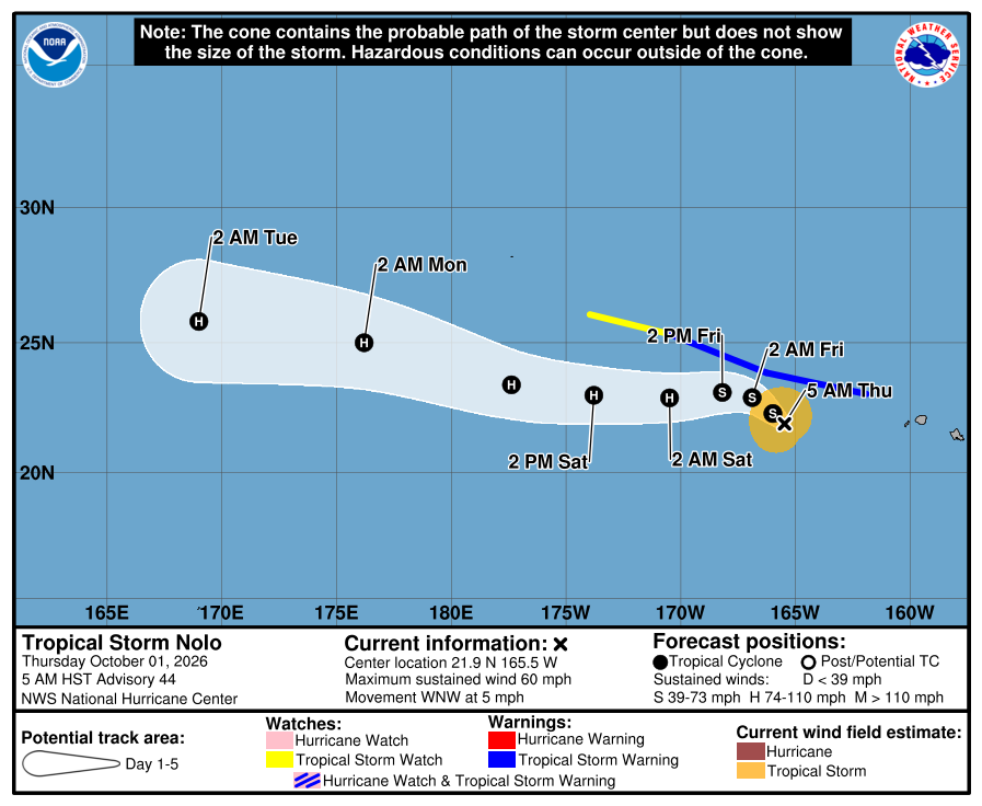
While Nolo is no longer a threat to the state of Hawaii, it is a threat to the islands and reefs located north and west of the state. Because of that threat, the National Hurricane Center has issued a Tropical Storm Watch from west of Maro Reef to Lisianski Island in the Papahanaumokuakea Marine National Monument. A Tropical Storm Warning means that tropical storm conditions are expected somewhere within the warning area while a Tropical Storm Watch means that tropical storm conditions are possible within the watch area, generally within 48 hours. The National Hurricane Center says additional watches and warnings may be required for additional portions of the Papahanaumokuakea Marine National Monument later this week.
In the latest update from the National Hurricane Center, Tropical Storm Nolo was located near latitude 21.9 North, longitude 165.5 West. Nolo is moving toward the west-northwest near 5 mph. A west-northwest to northwest track is expected today, followed by a westward turn with a large increase in forward speed by the
weekend. On the forecast track, Nolo should remain south of the main atolls of the Papahanaumokuakea Marine National Monument. Maximum sustained winds are near 60 mph with higher gusts. According to the National Hurricane Center, gradual strengthening is expected for the next day or so, and Nolo could once again become a hurricane by the weekend.
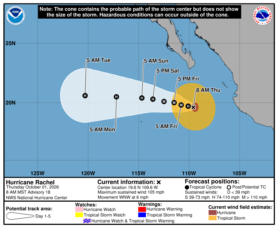
As of the latest information, Rachel was located about 230 miles south of the southern tip of Baja California with maximum sustained winds of 105 mph and minimum central pressure of 964 mb or 28.47″. Rachel is moving toward the west-northwest near 6 mph, and this west-northwest to west motion at a slightly slower forward speed
is expected the next couple of days. Maximum sustained winds have increased to near 105 mph with higher gusts. Some additional strengthening is possible during the next couple of days.
Swells generated by Rachel will affect the coast of west-central Mexico and the Baja California Peninsula through the end of the week. These swells are likely to cause life-threatening surf and rip current conditions.
Meanwhile, the National Hurricane Center says they expect no tropical cyclones to form anywhere in the Atlantic hurricane basin for at least the next 7 days. With no tropical cyclones expected, it is likely the Atlantic will break its record for being free of any hurricanes so deep into a hurricane season. The Atlantic Hurricane Season begins on June 1. In 1905, that season didn’t produce a hurricane until October 8, the latest ever a hurricane formed in the basin and it is likely the Atlantic will beat that record this year. Since records have been kept, the Atlantic has always created a hurricane but it is too soon to say with certainty whether that will happen this year.
