Image: U.S. Geological Survey
A magnitude 3.4 earthquake centered deep beneath south King County rattled the Seattle-Tacoma area late Friday, prompting more than 1,500 people to report shaking to the U.S. Geological Survey but causing no reported damage.
The quake struck at 11:13 p.m. PST Friday, or 1:13 a.m. CST Saturday, according to the USGS. It was centered near the Lea Hill neighborhood of northeast Auburn, about 4 miles northeast of Algona, at a depth of about 55 kilometers, or 34 miles.
The USGS listed the event as reviewed, with a local magnitude of 3.35, rounded to 3.4. The Pacific Northwest Seismic Network, which operates seismic stations in Washington and Oregon and contributes earthquake data to the USGS, located the quake.
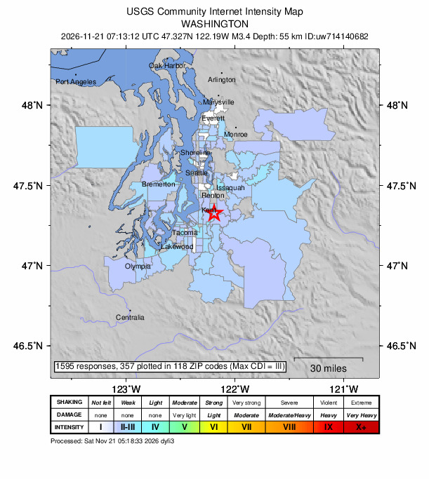
By Saturday morning, 1,595 people had submitted reports to the USGS “Did You Feel It?” system. The agency’s community intensity map plotted 357 of those reports in 118 ZIP codes, with the strongest shaking rated intensity III, described as weak.
The USGS ShakeMap, an automatic product generated by the seismic network, estimated maximum shaking of about intensity III. At that level, shaking is felt by people indoors, especially on upper floors, but typically causes no damage.
No tsunami was generated, and the USGS did not issue a PAGER alert, its system for estimating potential casualties and economic losses, which is generally produced for larger quakes.
Felt from Olympia to Everett
Reports came in from across the Puget Sound region. The largest numbers of plotted responses came from Seattle, Puyallup, Auburn, Tacoma, Kent and Olympia, according to USGS ZIP code data. People also reported feeling the quake as far north as Everett and across Puget Sound in Bremerton, Port Orchard and Gig Harbor.
Of the plotted reports, most came from ZIP codes where the average intensity was about II, the weak end of the scale, and about 100 came from areas averaging about III.
Several news outlets reported that the first automatic estimate placed the quake at magnitude 3.6, before a seismologist’s review lowered it to 3.4 and revised the depth slightly deeper. Rolling Out reported that no official reports of damage or injuries had surfaced by early Saturday.
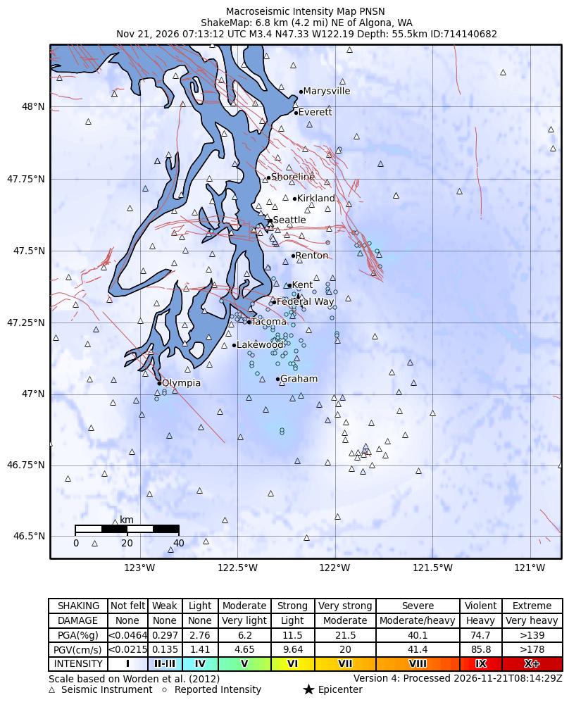
Image: Pacific Northwest Seismic Network/U.S. Geological Survey
The quake was too small to trigger earthquake early warning alerts to phones. International Business Times UK reported that guidance issued when ShakeAlert-powered alerts launched in Washington set thresholds of magnitude 5 or greater for Wireless Emergency Alerts and magnitude 4.5 or greater for the MyShake app.
As of about 6:40 a.m. CST Saturday, the USGS catalog showed no aftershocks of magnitude 0.5 or greater within 25 miles of the epicenter. The only other quakes recorded within that radius since Nov. 10 were small events of magnitude 1.4 to 2.2 near Snoqualmie, Kapowsin and Southworth, none of them related
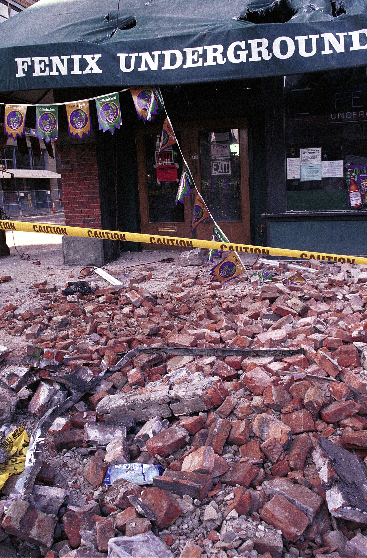
Image: Kevin Galvin/FEMA
.
Why a Deep Quake is Felt Widely
Earthquakes at that depth beneath the Puget Lowland typically occur within the Juan de Fuca plate, the slab of ocean floor sinking beneath North America along the Cascadia Subduction Zone. The USGS and the seismic network have not published an analysis of the source of Friday’s quake, so the type of faulting has not been confirmed.
The Pacific Northwest Seismic Network says seismologists group the region’s earthquakes into four types: Cascadia Subduction Zone quakes, deep intraplate quakes, shallow crustal quakes and volcanic quakes.
“The slab is bent and pulled by gravity,” the network says of the Juan de Fuca plate. “In a zone that ranges from near the coast to the foothills of the Cascades, but centered on the Puget Lowland, faults in this subducting slab produce deep intraplate earthquakes.”
Because their energy must travel tens of miles to reach the surface, deep quakes tend to spread weaker shaking over a broad area rather than concentrating strong shaking near the epicenter. That helps explain why a small quake was noticed by people across several counties.
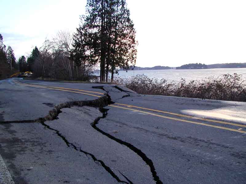
Image: U.S. Geological Survey
History of Damaging Deep Quakes
Small deep quakes are common under the Puget Sound region, but the same source has produced the state’s most damaging historic earthquakes.
“Most of the damaging historic earthquakes in Washington State, such as the 2001 Nisqually, 1965 Puget Sound, and 1949 Olympia earthquakes, were from this deep earthquake source,” the Pacific Northwest Seismic Network says.
The magnitude 6.8 Nisqually earthquake struck Feb. 28, 2001, at a depth of about 52 kilometers, or 32 miles, beneath the Nisqually River delta northeast of Olympia, according to the USGS. It damaged buildings in Seattle’s Pioneer Square, cracked roads and caused landslides across the region.
Friday’s quake released only a tiny fraction of the energy of that event. Each whole-number increase in magnitude represents about 32 times more energy released, according to the USGS, meaning the Nisqually quake released roughly 125,000 times more energy than a magnitude 3.4.
The Pacific Northwest also faces risks from shallow crustal faults and from the offshore Cascadia Subduction Zone, where strain has been building since the great Cascadia earthquake of 1700, the network says.
Shallow faults such as the Seattle Fault, which runs beneath the city, can produce quakes of up to about magnitude 7.5, and the Seattle Fault last produced a large earthquake around A.D. 900, International Business Times UK reported. Because those quakes start much closer to the surface and to population centers, they can cause stronger shaking than deep quakes of similar size.
Mount Rainier at Normal
The epicenter lies about 38 miles northwest of Mount Rainier, and there is no indication the quake was related to the volcano. In its most recent weekly update, issued Friday before the quake, the USGS Cascades Volcano Observatory said all volcanoes in the Cascade Range of Washington and Oregon, including Mount Rainier, were at normal background activity levels.
The observatory said small earthquakes were detected at Mount Rainier, Mount St. Helens and Mount Adams over the past week, and that all monitoring data remained consistent with background levels.
