The Eastern Pacific hurricane basin is starting to act up a bit with potential cyclone formation possible in the tropics in the coming days. The National Hurricane Center is tracking three areas for possible tropical cyclone formation; two of the three are already taking shape on satellite imagery.
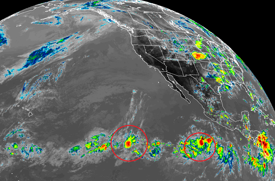
The first system being monitored by the National Hurricane Center (NHC) in Miami, Florida is a broad area of low pressure located more than 1000 miles southwest of the southern tip of the Baja California peninsula. It continues to produce disorganized showers and thunderstorms for now, and according to the NHC, environmental conditions are expected to be conducive for some gradual development of this system during the next few days while it moves west. While the NHC believes there’s only a 20% chance of tropical cyclone formation over the next 48 hours, those odds improve to 40% over the next five days.
The second system being watched consists of a broad area of low pressure located several hundred miles south of Manzanillo, Mexico. The NHC says there are some signs of organization and that environmental conditions are forecast to be even better for additional development in the coming days. While the storm moves west away from the coast of Mexico, it could become a tropical depression by the middle of the week. The NHC believes there’s a 50-50 shot of tropical cyclone formation within the next 5 days.
The third area hasn’t formed yet but the NHC expects it to. An area of disturbed weather is forecast to form south of the coast of Mexico by the middle of this week. Additional development is expected to occur after that time, and the system could become a tropical depression also by late this week as the disturbance moves west-northwestward parallel to the coast of Mexico. The NHC also believes there’s a 50% chance of tropical cyclone formation over the next 5 days.
Once and if these storms travel beyond 140°W, the Central Pacific Hurricane Center in Honolulu, Hawaii will assume responsibility for issuing forecasts and advisories, if any are needed, for these storms from the NHC.
As with the Atlantic Hurricane Basin, the Central Pacific Hurricane Basin, which includes all of Hawaii, hurricane season runs from June 1 through November 30.
