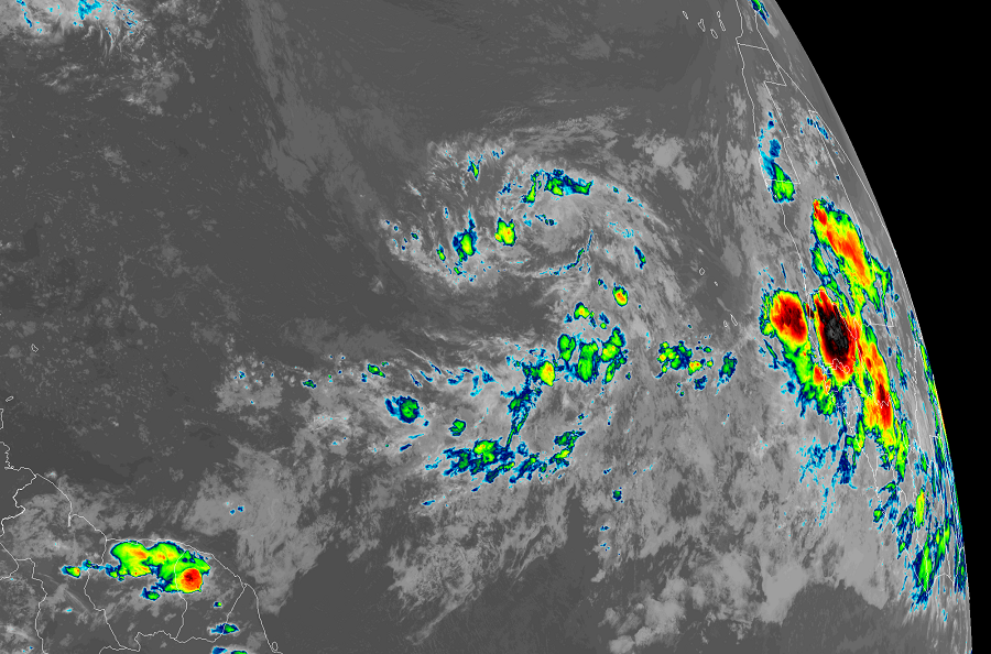
The National Hurricane Center (NHC) is tracking two disturbances near the west coast of Africa; one emerged over open water in the Atlantic while the other is still marching across the continental to the coast. The NHC gives both systems high odds of becoming tropical cyclones in the coming days and it’s possible that Tropical Storms Paulette and Rene could form before next weekend.
The first system of concern is a tropical wave located over the eastern tropical Atlantic. According to the NHC, this area continues to produce a large area of disorganized showers and thunderstorms. Gradual development of this system is expected while it moves westward to west-northwestward. The NHC says it is likely that a tropical depression will form here late this weekend or early next week when the system reaches the central tropical Atlantic. For now, the NHC believes there’s a 60% chance that a tropical cyclone will form here over the next 48 hours but ups those odds to 90% over the next 5 days.
The other system is another tropical wave located inland over western Africa; it is forecast to move offshore on Sunday. According to the NHC, gradual development of this system is expected and a tropical depression is likely to form by the middle of next week while it moves generally westward over the far eastern tropical Atlantic. While odds are low of tropical cyclone formation over the next 48 hours because the system still needs to move off-shore, odds are up to 80% that a tropical cyclone will form over the next 5 days from this disturbance.
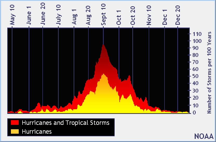
The Atlantic Hurricane Season runs through to the end of November. However, the traditional peak of the season is around September 10. While it’s inevitable that Paulette will form this season, it is also likely that storms behind it will form too; beyond Paulette, the remaining names on the list include Rene and Sally. Should any of these systems form soon, they would shatter records for the earliest “P”, “R”, and “S” storms on record in the basin. Currently, the earliest “P” storm on record was 2005’s Philippe which formed on September 17 of that year; the earliest “R” storm was Rita which formed on September 18 of the same year; the earliest “S” storm on record was Stan which also formed in a busy 2005 on October 2.
