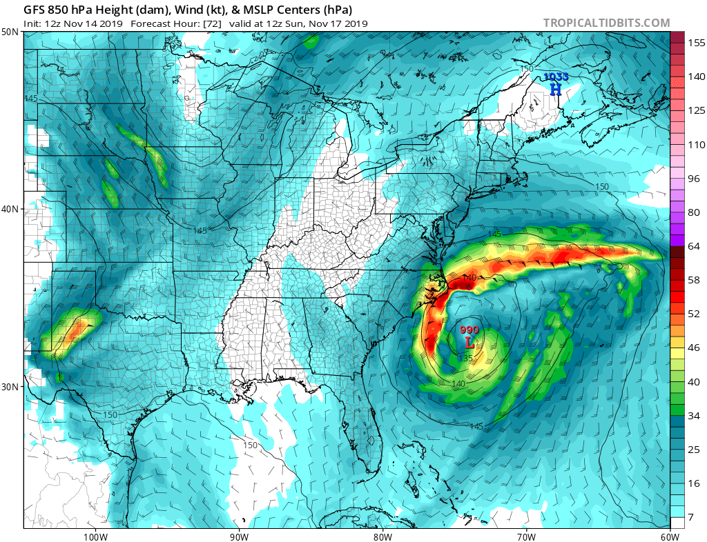
A slow-moving powerful area of low pressure is expected to form off the U.S. southeast coast this weekend and slowly move north and east up the coast, brushing much of the Southeast, Mid Atlantic, and New England coast with rough surf, windy conditions, and the potential for moderate to heavy precipitation. The center of the storm is forecast to remain off-shore, which will limit just how far inland from the Atlantic coast its impacts will be felt. Because it is expected to be a slow-moving system, impacts from the coastal low are expected to linger into the early to middle part of next week.
Low pressure is expected to develop off the Southeast coast on Friday, as a frontal boundary along the coast nudges eastward. This means conditions will clear out in the northeast while clouds build in the southeast. A potent cutoff upper low will slide across the southeast U.S. throughout the day on Saturday, before slowly pushing offshore and slowing into Saturday night. This will result in the formation of an area of surface low pressure that will rapidly strengthen into Saturday night off the Carolina coast. As another mid-upper trough pushes east out of the central Plains, and the surface high over the northeast begins to shift towards the east as well, the surface low will get dragged to the north. Heavy rain and lashing winds are likely in the Outer Banks of North Carolina which will be closest to the storm on Sunday. The coastal low will continue to move up the east coast, likely remaining well offshore through Sunday night. The outer precipitation shield could reach coastal Virginia, Delaware, Maryland, and New Jersey by Sunday night. A very strong pressure gradient will be established near the coast between strong high pressure to the north and the deepening low to the south. This will blow strong winds onto the Mid Atlantic and New England coast into Monday and Tuesday.
On Monday and Tuesday, the storm will continue to creep up the northeast coast. As moisture from the system is thrown west, cold air could be sufficient to produce sleet, freezing rain, snow, or a wintry mix of all. Where the frozen precipitation falls is dependent on the location and potency of the cold air mass in the northeast as well as the specific storm track that remains unknown. At the very least, the storm should brush up the coast, producing precipitation at least within 20 miles of the shore-line. Precipitation could reach far inland should the system’s track hug closer to the coast than currently expected.