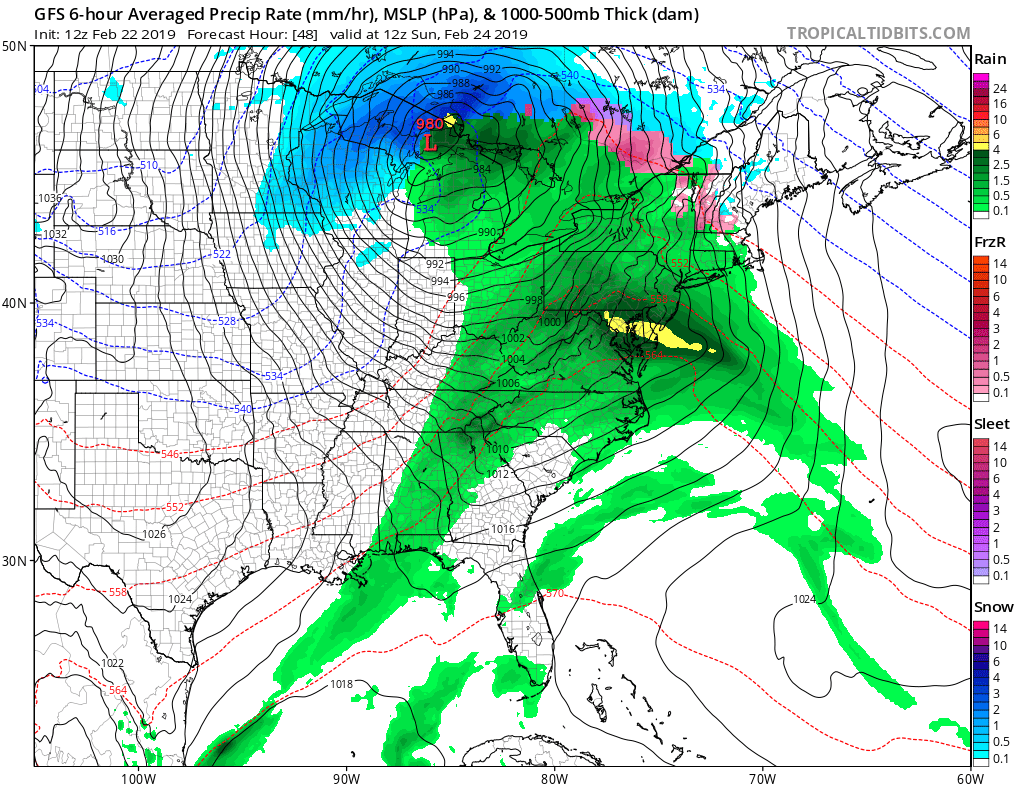
A storm system responsible for rare snowfall in the greater Los Angeles area and Las Vegas is marching east, destined to produce soaking rains for a large part of the Eastern United States. While snow fell in places like Burbank, Pasadena, Hollywood, and Malibu, very little snow is expected in the Eastern U.S. from this system. Because the storm center is forecast to move into the Great Lakes region and advance north and east into southeastern Canada, milder air will surge up the coast, producing rain instead of snow even far north. Some of the rain will be heavy at times, especially in the Mid Atlantic, while a severe weather threat exists in the Southeast.
On Saturday, the low will intensify near the Texas Panhandle while strong high pressure remains centered over the Northeast. This high will move offshore through the day while the low moves northeast toward Missouri. As the low moves in and the high retreats, clouds will increase with rain moving in from southwest to northeast in the East. Because the air mass ahead of this system won`t be very cold, only rain is expected in southern New England and the Mid Atlantic Saturday night. While higher elevations of New England could start out briefly as freezing rain or sleet, the deepening low will help push a warm front into the northeast, eliminating the chance for icy precipitation.

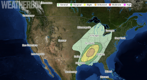
While wet weather will move into the northeast, severe weather will move into the southeast. According to the National Weather Service’s Storm Prediction Center and their latest Convective Outlook, severe thunderstorms with damaging winds, large hail, and the threat of tornadoes could impact the Southeast as the storm heads east. The greatest threat of severe weather appears to be near Missouri, Tennessee, and Mississippi.
While snow won’t be a major concern with this storm as it moves east, heavy rain will be. Rain in the Mid Atlantic will be heavy late Saturday night into early Sunday morning. The most vulnerable locations from this heavy rain could be the Rancocas Creek and the Raritan and Pacific basins in New Jersey. 1-2″ of rain is expected here.
As the storm pulls away on Sunday, the rain will fade, but the winds will pick up. On Sunday afternoon, as a deep mixed layer develops with winds in the boundary layer forecast to reach 40-50kts, wind gusts of 40-50mph could be possible, especially across Pennsylvania, New Jersey, Maryland, and Delaware. While it’ll be very windy, it will be mild with temperatures rising into the 50’s and 60’s as far north as the northern Mid Atlantic.
An approaching cold front will bring colder and dry conditions for Monday. The frontal passage could also set the stage for another round of damaging winds in the northeast, with 50-60mph northwest wind gusts possible early Monday.