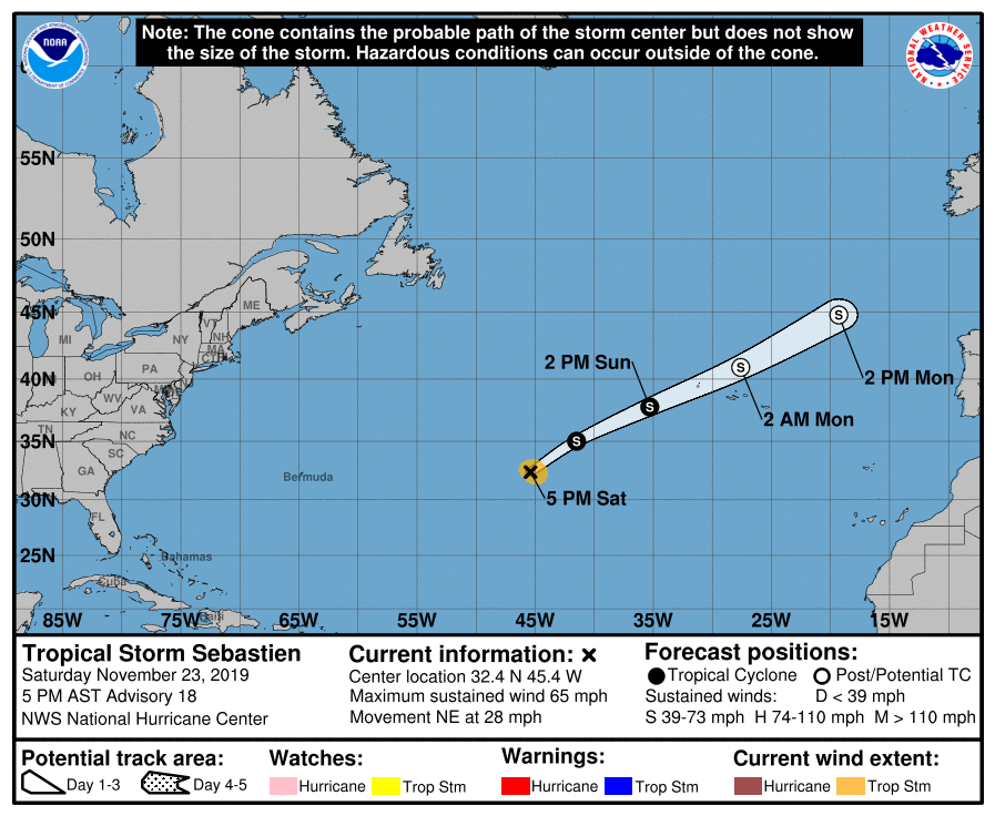
According to the latest information in from the National Hurricane Center (NHC) in Miami, Florida, Tropical Storm Sebastien is racing off to the northeast and could impact the Azores with heavy rain, gusty winds, and large swells in the coming days.
As of the last update from the NHC, the center of Tropical Storm Sebastien was located near latitude 32.4 North, longitude 45.4 West. Sebastien is moving quickly toward the northeast near 28 mph. A fast northeastward motion is expected for the next couple of days. Maximum sustained winds are near 65 mph with higher gusts, making it just shy of hurricane strength. Little change in the maximum winds is expected during the next couple of days, according to the NHC. Sebastien is forecast to become post-tropical on Sunday and dissipate early next week. For now, tropical-storm-force winds extend outward up to 90 miles from the center. The estimated minimum central pressure is 997 mb or 29.44 inches.
Regardless of its meteorological status, Sebastien or its remnants are expected to bring gusty winds and rain to the Azores beginning Sunday. The Portuguese Institute for the Sea and the Atmosphere (IPMA) is responsible for specific forecasts and advisories there. Swells generated by Sebastien are expected to reach the Azores early next week. These swells are likely to cause life-threatening surf and rip current conditions.
Elsewhere in the Atlantic, there are no other areas of concern as it relates to tropical development. The busy 2019 Atlantic Hurricane Season is due to come to a conclusion on November 30.