An area of strong to severe thunderstorms is pushing through the northeast now, bringing damaging wind gusts to the region which can knock down trees, wires, or both. But the thunderstorms pushing through will also help provide some relief to the extreme heat that has blasted the region in recent days with excessively high temperatures and humidity levels.
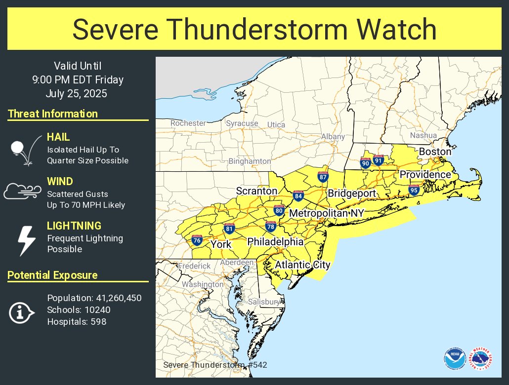
Due to ongoing severe thunderstorms and the likelihood of new ones forming, the National Weather Service’s Storm Prediction Center has issued a Severe Thunderstorm Watch for areas that include eastern Pennsylvania including the Philadelphia metro area, northern Delaware, much of New Jersey, the New York City metro area, Long Island and southeast Upstate New York, all of Connecticut and Rhode Island, and parts of Massachussetts. More than 41 million people are under this severe alert, where scattered wind gusts of 70 mph are expected in the most severe storms. The Severe Thunderstorm Watch is in effect through to 9pm this evening.
The frontal system responsible for firing-up today’s severe weather will take a more back-door orientation on Saturday, finally
allowing a noticeable air mass change for the region dealing with the latest summertime heat blast. This should bring a more stable and overall more pleasant day north of the Delmarva; south, dew points likely remain in the 70s. Some parts of northern New Jersey and Upstate New York may also see dewpoints drop into the 50’s for some crisp relief. However, the front will stall not far away, and as warmth and moisture start overriding it, a few showers or a thunderstorm might develop near where the boundary stalls. As such, Saturday will feel cooler than today but will still be very warm with highs mostly in the 80s with heat indices in the 90s.
More showers and storms will return to this region late Saturday into Sunday before more fair and dry conditions return on Monday.
