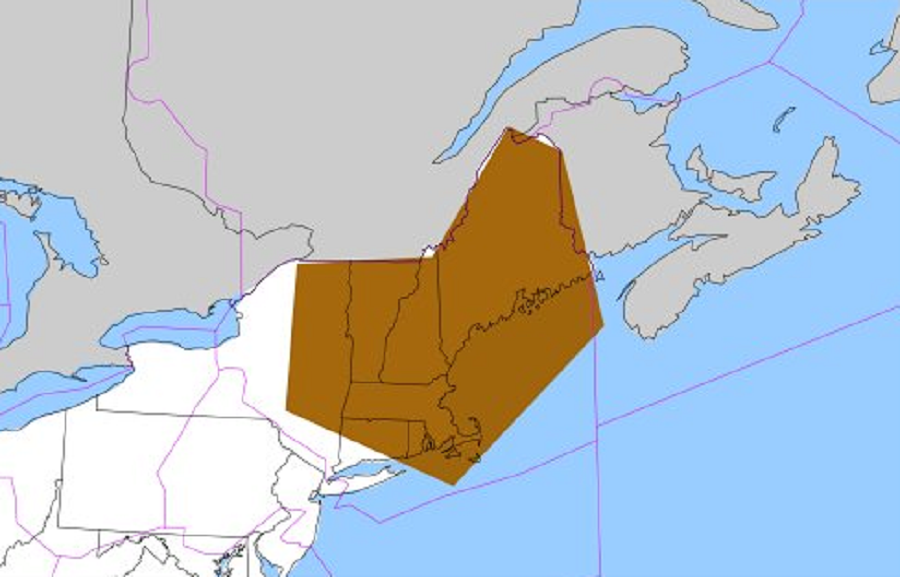
The National Weather Service’s Aviation Weather Center is warning of severe turbulence conditions across portions of the northeastern United States today. In addition to impacting air travel within the northeast on routes such as Boston-La Guardia, Albany-Newark, and Bangor-Providence, the area identified as one supporting severe turbulence also includes the highly trafficked corridor used for USA-Europe flights. Pilots are urged to use caution while flying in this zone with the SIGMET for Severe Turbulence.
A SIGMET, or “Significant Meteorological Information”, is a weather advisory that contains meteorological information concerning the safety of all aircraft. There are two types of SIGMETs: convective and non-convective. The criteria for a non-convective SIGMET to be issued are severe or greater turbulence over a 3,000-square-mile (7,800 km2) area, severe or greater icing over a 3,000-square-mile (7,800 km2) area or Instrument Meteorological Conditions (IMC) over a 3,000-square-mile (7,800 km2) area due to dust, sand, or volcanic ash.
Passengers on commercial flights operated in this area may have reduced or no service. Evening departures from east coast airports may have delayed meal services until crews find smoother air. While cockpit crews will attempt to avoid turbulence as best as they can, passengers should always keep their seatbelts secure and tightly fastened inside and outside of this turbulence zone. While a SIGMET may not be active for other areas, clear air turbulence could occur without notice.