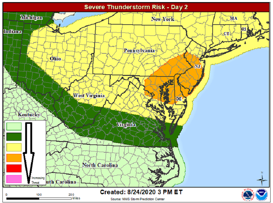
While the Gulf Coast is preparing for the impacts of an approaching hurricane threat, those in the Mid Atlantic and Northeast should also be aware of an evolving severe weather threat there. Damaging winds could be a problem, especially over portions of eastern Pennsylvania, most of New Jersey and Delaware, and northeastern Maryland. The Washington, DC, Baltimore, MD, and Philadelphia, PA metropolitan areas are included in this area. While not everyone will see a thunderstorm in this region, scattered thunderstorms will blossom and some neighborhoods could be hit hard. The greatest chance of severe storms is between 2pm and 8pm.
According to the National Weather Service’s Storm Prediction Center, a strong cold front is forecast to shift across the U.S./Canada border and move quickly eastward across New England, while progressing more slowly southeastward across the Mid Atlantic region and southward across the central Appalachians. In this area, isolated general thunderstorms may be ongoing Tuesday morning and lending some uncertainty regarding destabilization across lower elevations near the coast ahead of this activity. However, west-northwesterly flow in the mid levels is forecast to strengthen during the day across the region and support relatively fast multicell storms.
The greatest risk for severe gusts and associated tree/wind damage will occur farther south across parts of eastern Pennsylvania and New Jersey into the Chesapeake Bay area. Atmospheric ingredients will set the stage for multiple thunderstorm clusters and line segments capable of producing isolated winds of 55-65 mph. Winds at these speeds could create patches of wind damage and power outages from downed trees and branches. The greatest threat from these storms will be from damaging winds; large hail and isolated tornadoes, while possible, won’t be the primary threat for Tuesday’s severe weather event.
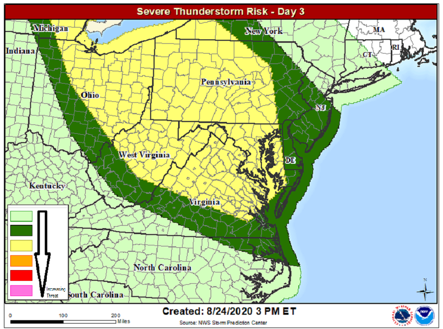
While most severe weather should wrap up by the late evening hours in the Mid Atlantic, there’s another chance of severe weather a bit more south than Tuesday’s on Wednesday. Damaging wind gusts will be theme for Wednesday’s storms too moreso than other threats that could come from storms, such as hail and tornadic activity.
