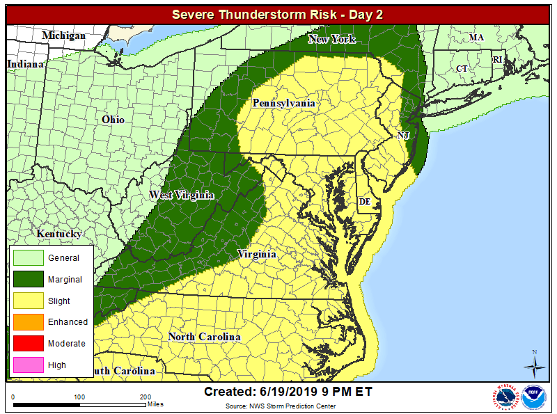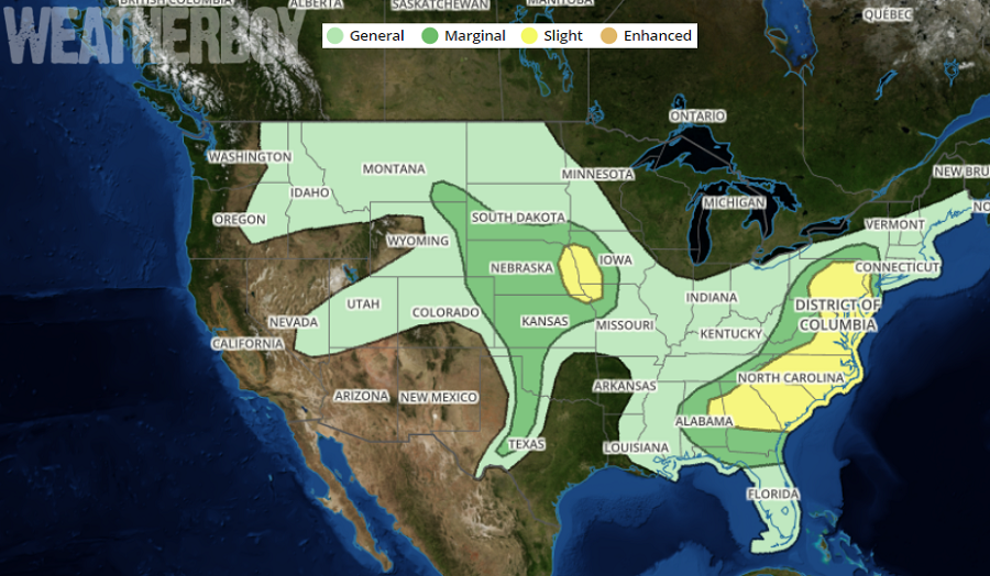
After a break in severe weather in the Mid Atlantic that lasted just a day today, it appears more severe weather will be returning tomorrow along with more heavy downpours. Unlike the severe weather threat areas that impacted a small area of the Mid Atlantic, tomorrow’s rough weather will be more widespread, with strong to potentially severe storms expected over much of Pennsylvania, New Jersey, Maryland, Delaware, Virginia, and North and South Carolina.
A variety of meteorological ingredients are coming together to produce tomorrow’s expected severe weather outbreak. An upper trough in the central U.S. is forecast to approach western Ohio and central Tennessee by lunchtime tomorrow as the strongest mid-level flow translates across the southern Appalachians toward the North Carolina Outer Banks region by early evening. The associated surface front should prove convectively active tomorrow with thunderstorms expected to be ongoing across Ohio, Kentucky, Tennessee, and northern Alabama in the morning. While a few storms may be strong at day break, strongest heating, leading to greater buoyancy, should occur from central Pennsylvania south across the Carolinas into Georgia. This corridor of increased instability should encourage robust convection within an increasingly sheared environment for organized thunderstorms. At this time it appears damaging winds will be the greatest risk, but some supercell/tornado threat is also expected ahead of the forced frontal convection.
Residents in the zone with potential severe storms tomorrow should prepare ahead of time and know what to do should Severe Thunderstorm or Tornado Warnings be issued. Even non-severe storms can be deadly: when thunder roars, head indoors; if thunder is close enough to be heard, lightning is close enough to kill.
