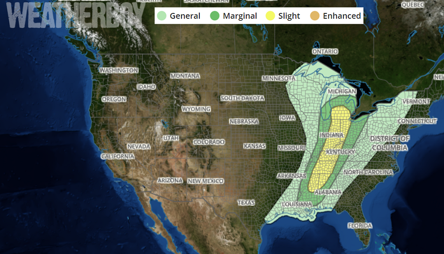
Severe weather connected to a potent storm in the Rockies will continue to march east. Tomorrow, the severe weather is likely to be centered in an area stretching from Michigan to Mississippi. On Friday, the area of thunderstorm activity will shift to the East Coast, but the threat of severe activity will be greatly diminished by then.
Strong to severe thunderstorms are possible from portions of Mississippi and Alabama northward through central Tennessee and Kentucky into Indiana, western Ohio and southern Michigan. Damaging winds, hail and tornadoes will all be possible from midday through the evening hours on Thursday.
The reason for the severe weather is a strong system marching east across the country. A mid-level low will weaken and evolve into an open mid-level wave as it moves from the Nebraska/Iowa border to Lake Huron during the period. In the low levels, a deep surface low will weaken but develop northeast coincident with the mid-level trough. A cold front aligned south-southwest from eastern Iowa to central Arkansas to near the Texas Gulf Coast at the beginning of the period will move eastward across the Midwest to the lower Mississippi Valley by Thursday evening. As it moves through, severe thunderstorms will form.
On Friday, the system will head to the east coast, bringing another round of rain to an area already soggy by all the rain that fell this winter. With the storm system moderating, while thunderstorms are possible from New Jersey to Florida, they aren’t expected to become severe at this time.