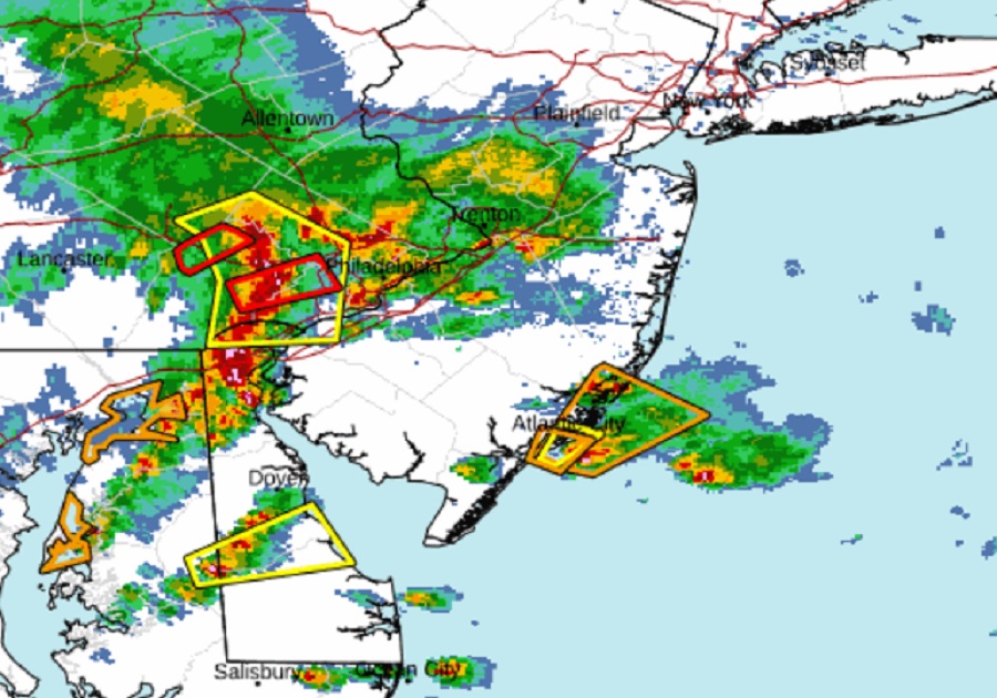
Severe weather, including some tornado-warned cells, are impacting the Philadelphia metro area as well as southeastern Pennsylvania, southern New Jersey, Delaware, and eastern Maryland. Due to the threat of severe weather today, the National Weather Service’s Storm Prediction Center (SPC) has issued a Severe Thunderstorm Watch for the region until 6pm today.
Be aware of the threat of tornadoes around Philadelphia and Southern New Jersey today! #NJwx #PAwx https://t.co/AVjhM7Y4ZR
— the Weatherboy (@theWeatherboy) June 16, 2023
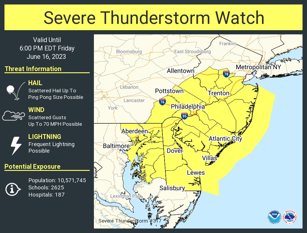
A Severe Thunderstorm Watch means conditions are favorable for severe thunderstorms in and close to the watch area. Persons in these areas should be on the lookout for threatening weather conditions and listen for later statements and possible warnings. Severe thunderstorms can and occasionally do produce tornadoes. For today’s severe weather outbreak, the primary threats include scattered damaging wind gusts to 70 mph and scattered large hail events to 1.5″ in diameter possible.
In the Mid Atlantic, there will be multiple rounds of thunderstorms which will track across the watch area through the afternoon, posing a risk of damaging winds and hail. Some tornadic cells have also popped-up, prompting the National Weather Service to issue Tornado Warnings in parts of the Philadelphia metro region.
A Tornado Warning is issued when a tornado is observed by a trained spotter and/or indicated by weather RADAR. Should a Tornado Warning be issued for your area, the National Weather Service warns you to take immediate cover; move to a basement or an interior room on the lowest floor of a sturdy building. Avoid windows. If you are outdoors, in a
mobile home, or in a vehicle, move to the closest substantial shelter and protect yourself from flying debris. In a Tornado Warning, you may only have seconds or minutes to act to save your life.
