The National Weather Service has issued a Severe Thunderstorm Watch and a Flash Flood Watch for portions of the Mid Atlantic where rough weather is expected this afternoon.
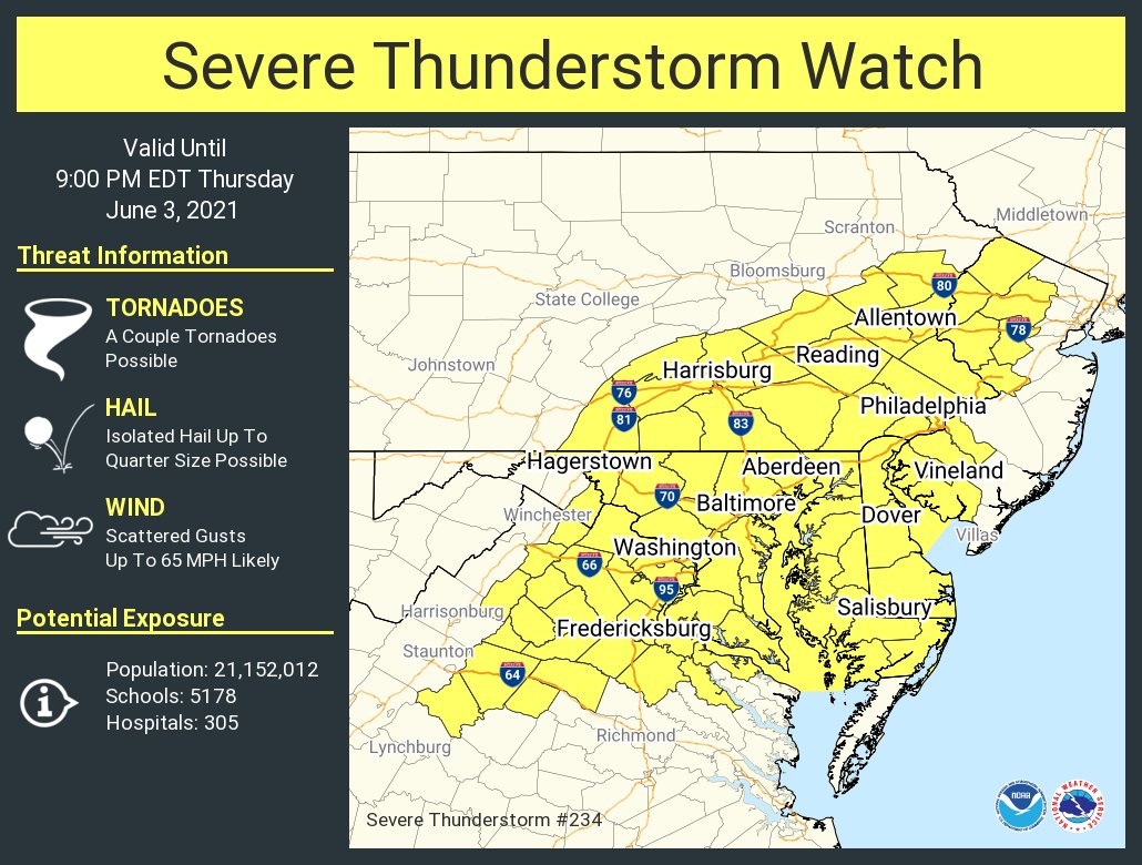
The Severe Thunderstorm Watch, which is in effect for portions of Pennsylvania, New Jersey, Maryland, Virginia, and all of Washington DC and Delaware runs through 9pm tonight. In this area, scattered damaging wind gusts to 65 mph are likely. Large hail, up to quarter size, is possible in some isolated storms. There is also a risk of isolated tornadoes within these storms later this afternoon and evening. More than 20 million people live within this heavily populated severe thunderstorm watch “box.”
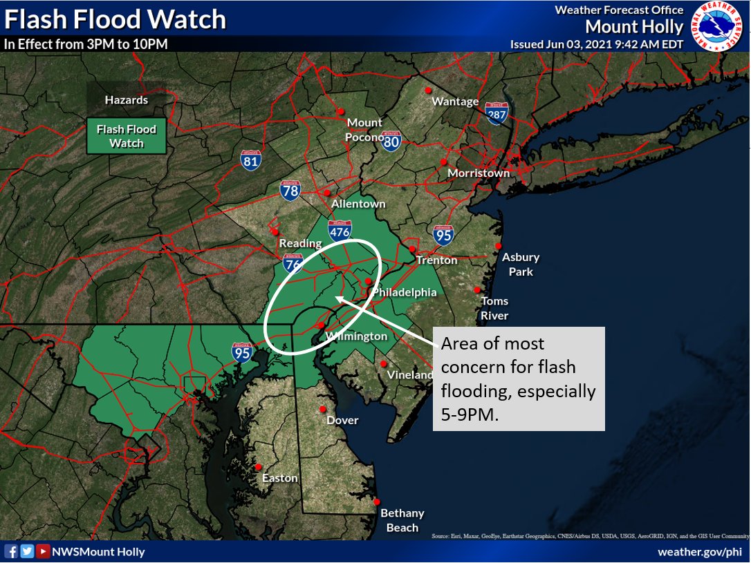
In addition to severe storms, there is also a threat of flooding rains. Due to the flood threat, the National Weather Service has also issued a Flash Flood Watch for portions of southeastern Pennsylvania, southwestern New Jersey, northern Delaware, and northeastern Maryland through 10pm this evening. The greatest threat of flash flooding is in northern Delaware and southeastern Pennsylvania during a window between 5pm and 9pm.
The National Weather Service reminds people to avoid flood waters: “Turn around, don’t drown; never drive through flood waters.”
The National Weather Service is also warning people outside of these watch areas that weather hazards can exist even in those areas. Lightning from thunderstorms that don’t reach severe criteria can still be deadly. Due to that, the National Weather Service advises, “when thunder roars, head indoors; if thunder is close enough to be heard, lightning is close enough to kill.”
Today’s rough weather is being caused by a potent frontal system moving through the Mid Atlantic. While today is the 1 year anniversary of a destructive derecho that moved through the same area, a derecho is not expected today. However, flooding rains and severe thunderstorms with isolated tornadoes can still wreck havoc on the region through to the evening hours tonight.
