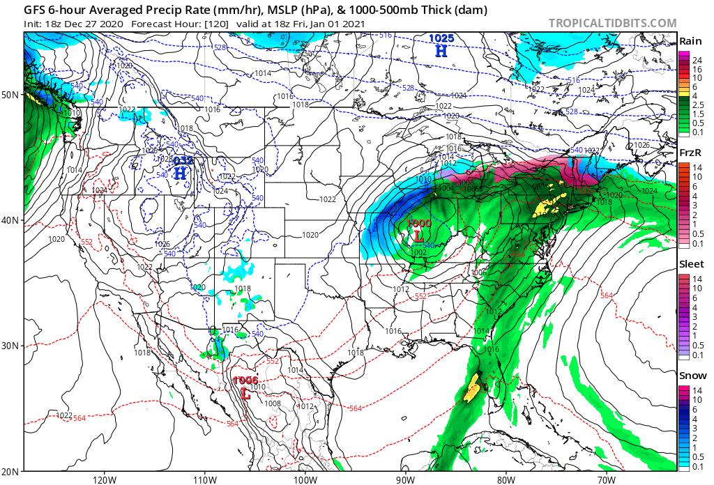
Computer forecast models continue to project a significant storm system in the eastern United States, bringing a mixed bag of weather from the Great Lakes and Deep South east.
While storm specifics still need to be flushed out in the coming days, it appears there will be three trouble areas with this storm: heavy snow on the backside of the storm over the Midwest, severe storms and heavy rain from the Mid Atlantic into the Southeast, and an icy mess across central and northern New England.
Heavy snow, 6-12″ or more, could fall over parts of the Midwest. The best odds for the heaviest snow will be over Wisconsin, Iowa, Illinois, and Missouri.
Heavy rain and strong thunderstorms could impact a large part of the east coast, with a severe weather threat stretching from portions of Florida north to portions of New Jersey. Some of these areas were hit hard by damaging winds and tornadoes on Christmas Eve.
Unlike the Christmas Eve storm in which milder air surged north to the Canadian border, there’s a chance just enough cold air could linger in central and northern New England to set the stage for an icy mess. While accumulating snow is possible over northern New England, accumulating sleet and freezing rain will be possible over portions of southern and central New England.