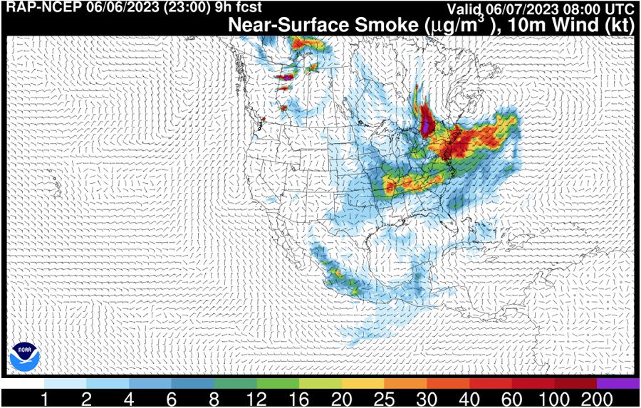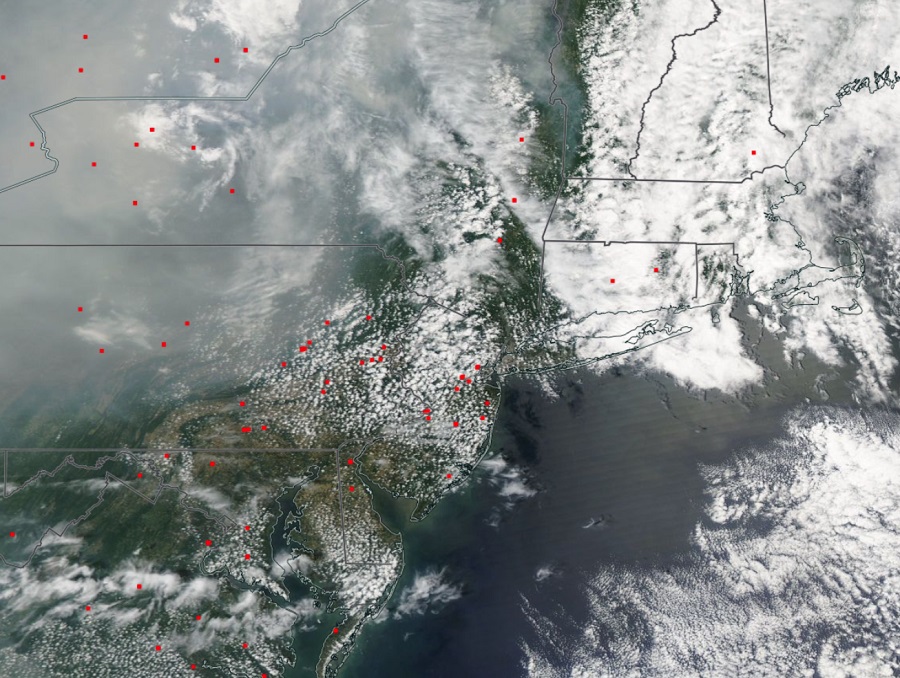
Smoke from Canadian wildfires is creating exceptionally smokey conditions across much of the northeast today and it looks like the air flow around those fires will make the smoke even become more thick for portions of New Jersey, Pennsylvania, Connecticut, Rhode Island, and Massachusetts tomorrow. Making matters worse are wildfires closer to home; NASA analysis and satellite imagery shows dozens of fires burning across portions of New York, Pennsylvania, New Jersey, New Hampshire, and Connecticut, adding the the smoke and pollutants in the air.
Smoke from recent wildfires in Nova Scotia, Quebec, New Brunswick, and Ontario provinces in eastern Canada has made its way down the U.S. East Coast, covering much of the northeast under a veil of smoke. Due to the abundance of smoke, an air quality alert has been issued for the area.
A variety of state or regional organizations have issued air quality alerts for the smoke. The New Jersey Department of Environmental Protection has issued a Code ORANGE air quality alert for the entire state. The Pennsylvania Department of Environmental Protection also issued a Code ORANGE alert for the Lehigh Valley, the Susquehanna Valley, and Berks County areas. The Delaware Valley Regional Planning Commission issued the same for the entire Philadelphia metro region. The New York State Department of Environmental Conservation has issued an Air Quality Health Advisory for the entire metro New York City region area too.
In addition to Canadian fires, there are also numerous fires throughout the northeast too. NASA FIRMS satellite data shows dozens of fires throughout the northeast that are burning, adding additional smoke to the atmosphere.

One significant fire is being fought by the New Jersey Forest Fire Service in Jackson Township in Ocean County. There’ fire fighters are fighting an out-of-control fire near I-195 in the central part of New Jersey. In the New Jersey Forest Fire Service’s last update at 8 pm, the fire has spread to over 30 acres, is 0% contained, is threatening at least 30 structures, and has forced road closures around East Commodore Boulevard and Cedar Swamp Road there. While the fire burns, there are no mandatory evacuations in place there for now.
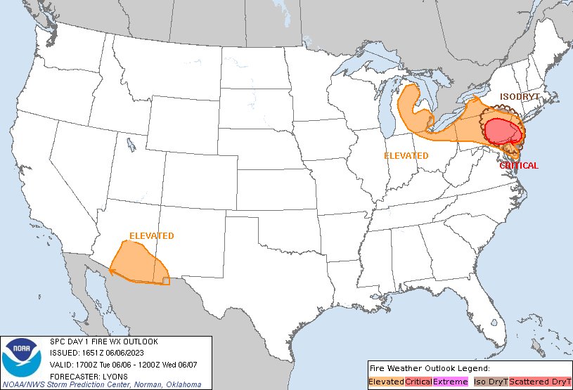
The National Weather Service’s Storm Prediction Center, which monitors conditions for Fire Weather, also has much of eastern Pennsylvania and southern New Jersey under a “critical” category today. The dry state of area fuels, such as dried-out grasses, bushes, and trees, combined with breezy northerly winds and scattered fire-igniting lightning strikes is making weather conditions there ripe for fires to form and/or spread. Red Flag Warnings are up for New Jersey, with Stage 3 fire restrictions up in northern and central New Jersey and Stage 2 fire restrictions in southern New Jersey. “Any fires that develop may quickly get out of control and become difficult to contain,” the New Jersey Forest Fire Service warns.

Forecast models show the smoke becoming even more concentrated over eastern Pennsylvania, much of New Jersey, the New York City metropolitan area, Connecticut, Rhode Island, and much of Massachusetts during the day tomorrow, which could make it difficult to breathe outside, especially for those with asthma and other respiratory ailments.
While smoke will enter the region from Canada and from the other fires burning in the northeast, the National Weather Service is providing advice to prevent the start of additional fires. The National Weather Service cautions: “Properly discard cigarettes; keep vehicles off of dry grass; avoid activities with open flames or sparks; avoid power equipment that creates sparks; obey burn bans; evacuate if fire/smoke is heading your way; evacuate if ordered to do so by local officials.”
Unfortunately, it appears the air quality will even be worse tomorrow than it was today for many in the northeast. Take care of yourself and your loved ones! #Fire #Smoke https://t.co/ZIhNL1wURk
— the Weatherboy (@theWeatherboy) June 7, 2023