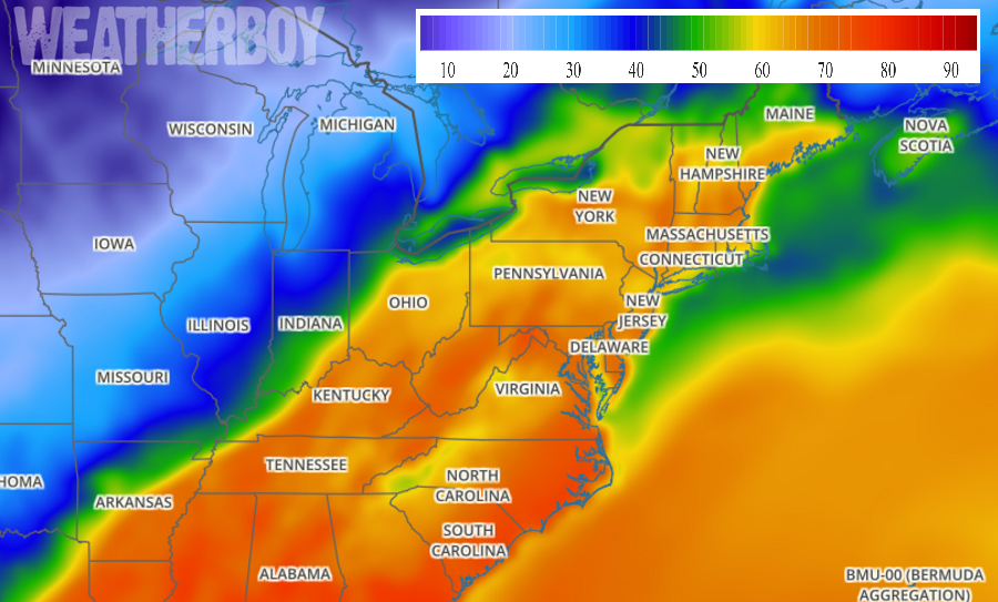
While more than 6″ of snow fell overnight in portions of Pennsylvania, New Jersey, and southeastern New England, a dramatic warm-up is on the way, with some record warmth in the forecast for the upcoming week in the eastern United States.
Before the warm air arrives, though, there could be some cold weather hazards at night. Any snow melting in this region during the day will re-freeze on untreated surfaces at night as temperatures drop below freezing after mild days. With the changing air mass, dense fog may become a widespread problem across portions of the Mid Atlantic and New England. With threats of fog, ice, and perhaps even freezing fog, there’s a risk of slick conditions; always drive with care and caution, even if the air temperatures feels mild to you.
The evolving weather pattern will help steer warm air from the south to the north. The flow aloft will begin to become more southwesterly tonight, allowing for warm air advection to take place in the eastern US. There are some weak short waves riding the northern side of the gradually building ridge, and these along with an increase in warm air advection could generate some clouds in the Mid Atlantic later tonight. Cloud cover impacts temperatures; with winds light to calm and dew points low, there could be significant radiational cooling in areas lacking clouds. Those areas where clouds do form will be a bit milder. The less clouds, the more likely temperatures will head well below freezing.
A very warm and strong high pressure ridge will build along the East coast this week. Temperatures in the Mid Atlantic and Northeast should be about 3-5 degrees above normal on Monday, 20-25 degrees above normal on Tuesday, and 25-30 degrees above normal on Wednesday. High temperatures should soar into the mid 70s as far north as central New England. Places like New York’s capital district will be in the low to mid 70’s while cities further south, like Philadelphia and Washington, DC enjoy temperatures more common with mid-spring than mid-February.
Temperatures will remain above normal on Thursday and Friday before another pattern change arrives. Temperatures on Thursday and Friday will be mild, but not nearly as mild as Tuesday and Wednesday with highs 5-10 degrees above normal on Thursday and about 5 degrees above normal on Friday.