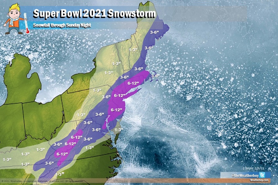
A coastal storm will bring a fresh round of heavy snow to portions of the Mid Atlantic and New England in time for Super Bowl Sunday this weekend. Unlike the storm earlier in the week that brought more than 30″ of snow to portions of northeastern Pennsylvania and northern New Jersey, the heaviest snow from this coastal storm should be a bit more south into portions of southeastern Pennsylvania, New Jersey, and north and east into southeastern Massachusetts.
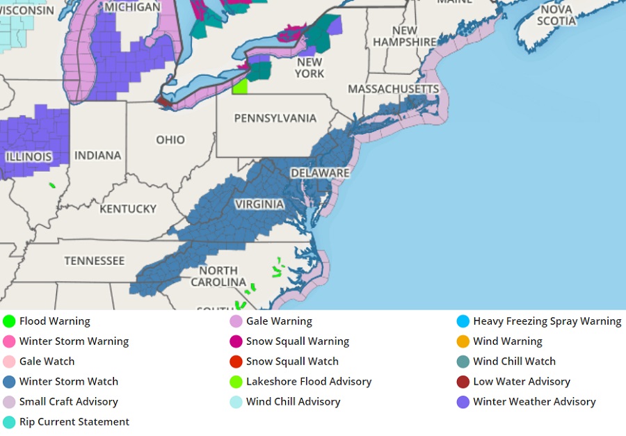
In anticipation of another round of heavy snow, the National Weather Service has issued Winter Storm Watches for Saturday night into Sunday from the southern Appalachian Mountains in northern Georgia, northwestern South Carolina, eastern Tennessee, and western North Carolina through eastern West Virginia, much of Virginia and Maryland, all of Delaware, much of New Jersey, the New York City metro area and all of Long Island, southern Connecticut and Rhode Island, and southeastern Massachusetts. In the Winter Storm Watch area, snow could accumulate 5, 6, or more inches by the time it stops by Sunday evening.
By the time the storm wraps up on Super Bowl Sunday evening, around 6-8″ of fresh snow should be on the ground in Philadelphia and New York while 4-7″ are expected in Boston and Baltimore. 3-5″ are expected in Washington, DC.
Some sleet may mix in with times and cut snow accumulations down over portions of southern Delaware and southern New Jersey. Because of that, forecast totals of snow will be trimmed down to 1-3″ over Cape May and over the southern half of Delaware. However, if sleet or any other mixed precipitation stays off-shore, snowfall amounts there could increase by as much as double.
Because the storm system will be moving fast, widespread damaging winds and large scale coastal flooding are not expected at this time. Should either of those change, the National Weather Service will issue specific advisories for those threats if it appears they’ll materialize.
