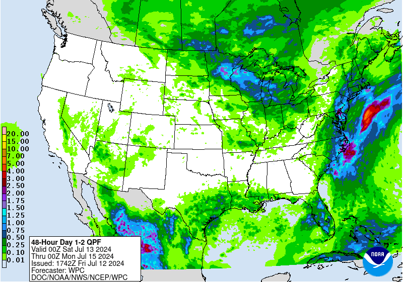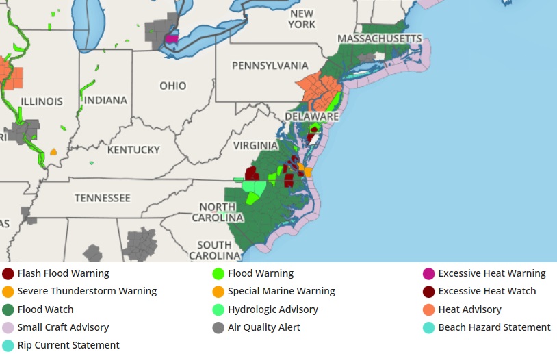
A soaking Friday continues across portions of the Mid Atlantic prompting the National Weather Service to issue flood-related advisories due to flood concerns there.
A quasi-stationary frontal boundary draped along the East Coast will continue to remain a focus for numerous showers and thunderstorms through tonight. Plentiful moisture pooling along the eastern side of the boundary as air flows in from the Atlantic will lead to heavy rainfall rates, and with flow along the boundary leading to repeated rounds of storms increasing the chance for accumulating rainfall.
A similar scenario will be in place Saturday, although the boundary is expected to shift slightly eastward, limiting the threat for locally heavy rainfall and flash flooding closer to the coast. An incoming upper-level shortwave will help to reinvigorate storm development, with the greatest potential for storm coverage and heavier rainfall currently forecast over portions of southeastern Pennsylvania/southern New Jersey into the northern DelMarVa Peninsula.
By Sunday, the front is forecast to shift even further eastward on Sunday, keeping the showers and storms mostly offshore and leading to a much more dry day along the East Coast.

For now, the National Weather Service has issued Flood Watches from northeastern South Carolina into eastern North Carolina, Virginia, and Maryland, all of Delaware, New Jersey, and Rhode Island, and portions of New York, Pennsylvania, Massachusetts, and Connecticut. Within the Flood Watch, Flood Warnings are now in effect due to flooding happening right now in portions of North Carolina, Virginia, New Jersey, and Delaware.