While the current weather pattern does not support blockbuster snowstorms for the I-95 corridor between Washington, DC and Boston, MA this month, it is supportive of a very wet train of storms to impact the region. Yet another significant storm will impact the Mid Atlantic and New England; despite the recent frigid temperatures, this next system will be milder than the last, bringing rain to a much wider area. The primary impact day from this storm will be Thursday.
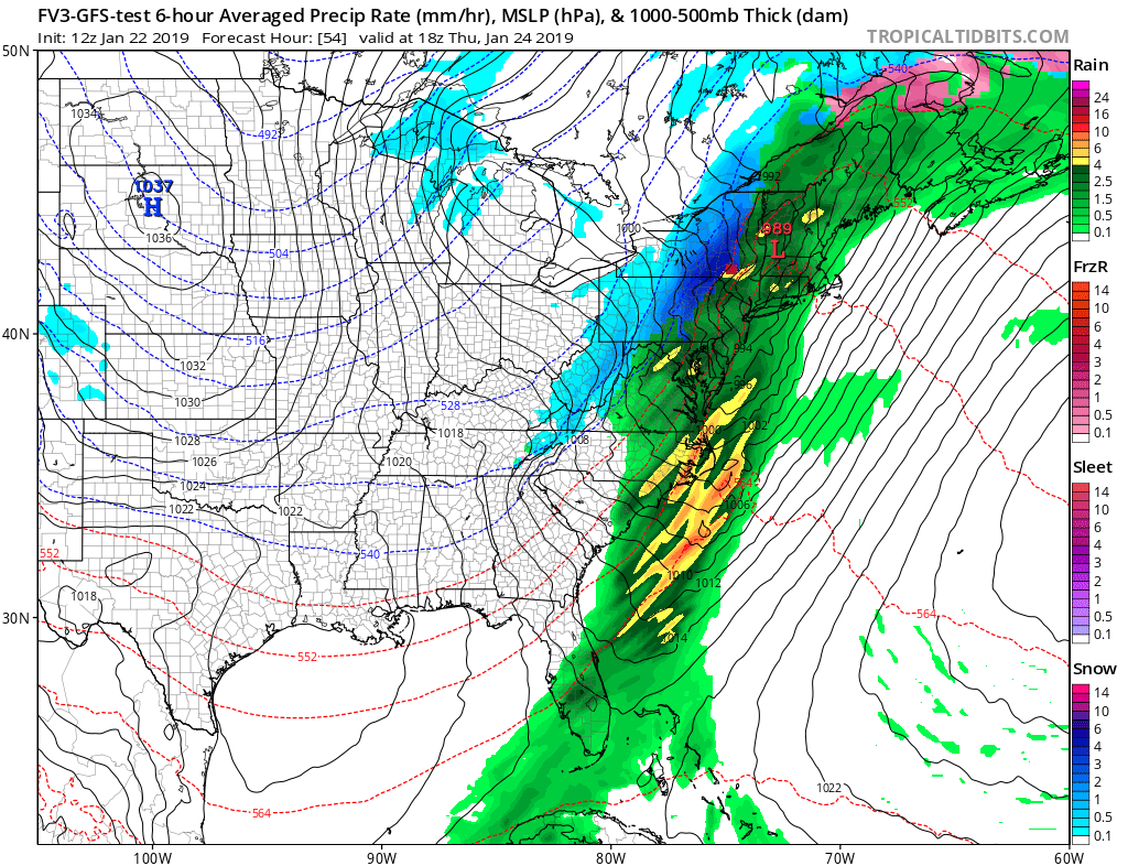
Before the storm arrives, conditions will moderate in the East to allow for this rainy scenario. Arctic high pressure across the Mid-Atlantic region will move offshore by tonight. As the high slides away, low pressure will move into the Great Lakes region tomorrow and then down the Saint Lawrence Valley on Thursday. Its associated fronts will cross the northeast tonight and Thursday.
With warmer air surging up the coast ahead of this storm system, temperatures will become too warm to support any freezing or frozen precipitation along the coastal plain north into the eastern half of New England. Even northern New Hampshire and Maine will see rain from this system due to that surge of mild air moving north. However, in some of the higher elevations of eastern Pennsylvania and upstate New York, along with West Virginia and western Virginia and Maryland, there will be some marginal thermal profiles that could support snow, sleet, or freezing rain for a time before a changeover to rain occurs. Further west, across the highest terrain of central West Virginia, western Pennsylvania, and western Upstate New York, it will remain cold enough to fall as plain snow throughout the system.
Where only rain will fall, it could be heavy at times with another 1-2″ possible. Added to the recent rain in the Mid Atlantic or the recent snow in eastern New England, there could be some isolated flood threats Thursday, especially during the PM hours. In areas where only snow is expected, as much as 5-10″ of snow will fall. Areas that do see freezing rain and sleet should only see it for a short period; while that could lead to dangerous, icy conditions while they occur, they should be short-lived and be quickly replaced by plain rain conditions.
High pressure will build back across the eastern United States late Friday into Saturday, with dry conditions forecast. Below-normal temperatures will return to the northeast for the weekend.
While some forecast models suggested a sizeable snowstorm in the eastern United States for Sunday into Monday, such a scenario seems very improbable at this time.
