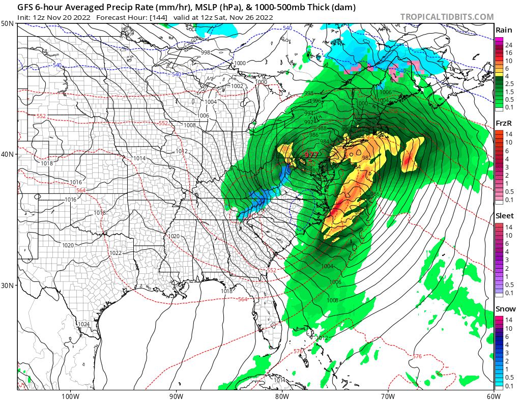
A potent storm system is forecast to take shape in the eastern United States right after Thanksgiving; however, it appears this will be more of a wet storm than a white one with milder air surging up into the northeast ahead of the storm’s arrival. As the storm exits, it is possible there will be some more lake effect snow in its wake, but any snow that does fall will be inconsequential compared to the epic amounts of snow that fell over the weekend.
Wind flowing at just the right trajectory into an environment ripe for rapid snow development set the stage for an epic lake effect snow event over the weekend. According to the National Weather Service office in Buffalo, New York, Hamburg received the most snow from the multi-day event, getting a storm total of 81.2″. Orchard Park picked up 80″; Athol Springs saw 73.7″, Natural Bridge got 72.3″, and Watertown got a still-impressive 62″ of snow.
A new storm will slide across the country in the coming days but the trajectory and atmospheric ingredients in place will be very different from this past weekend. As such, a significant lake effect event is unlikely to unfold.
For New York City and much of the I-95 corridor in the northeast, high pressure will slowly be pushing off to the east ahead of the next system but will remain largely in control on the holiday. While cloud cover will be increasing, the weather should be dry and tame for the holiday.
Beyond then, low pressure should quickly move north and east into the Mid Atlantic and Northeast, bringing soaking, wind-whipped rains to the region by Saturday with Friday being a transition from the dry conditions on Thanksgiving to the rainy Saturday.
While cold air will flow around on the back side of this system, there’s only a marginal chance of light lake effect snows in its wake. There are better chances of snow across northern New England where colder air will wrap around in time while there’s still ample moisture to produce measurable snow. By the time colder air arrives into the I-95 corridor and the major cities there, the moisture should be gone, preventing any snowfall there.
While there could be a coating of snow down-wind of the lakes from this next storm in New York, there could be 3-6″ of snow across northern and higher elevation regions of Vermont, New Hampshire, and Maine.
More Lake Effect snow is likely during the middle part of next week. While more snow is likely in upstate New York and northwestern Pennsylvania from that, it doesn’t appear there will be a threat of measurable snow into the I-95 urban corridor for at least the next 10 days.
