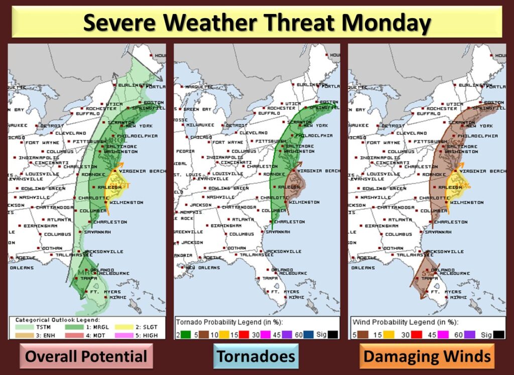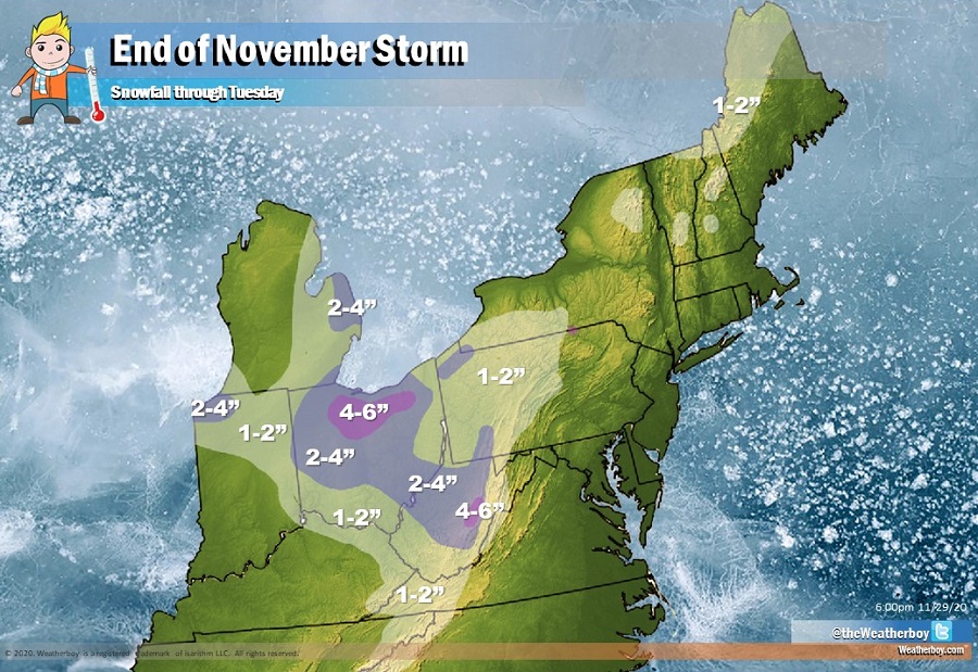
A potent storm system moving into the Great Lakes region tomorrow will bring accumulating snow to portions of the Great Lakes and Ohio Valley while bringing gusty, potentially damaging winds and isolated tornadoes to portions of the U.S. East Coast. The last storm of November 2020 will help kick off a cold start for the last month of the year.
High Pressure located off of the Mid Atlantic coast now will push further offshore this evening while an area of low pressure, currently over the Northern Gulf Coast, will lift rapidly to the north and east. The low will deepen rapidly as it lifts northward, being energized by the favorable phasing of the northern and southern branch shortwaves. Early Monday, a robust moisture transport will help bring soaking rains north up the coastal plain of the East Coast from the Gulf Coast. This anomalously rich moisture feed combined with the dynamics associated with the subtropical jet stream and approaching shortwave will generate a period of moderate to potentially even heavy rainfall over the East Coast. Atmospheric dynamics will also set-up which could be favorable for severe weather, especially for portions of the Mid Atlantic during the afternoon hours on Monday.
Due to the threat of strong winds, the National Weather Service is issuing wind-related advisories for portions of the East Coast. Beyond these strong sustained winds, there could also be damaging wind gusts. The best chance of damaging wind gusts will stretch from Connecticut and Rhode Island south down the East Coast to the Carolinas, with the Outer Banks of North Carolina in the bullseye. This same area, especially from Virginia Beach, Virginia south to Wilmington, North Carolina, could see isolated tornadoes too. The threat of isolated tornadoes will reach as far north as the New York City metropolitan area and southern New England and south to central South Carolina. There’s also an isolated threat of tornadoes across central Florida from Tampa to Cape Coral across to Jacksonville to Cocoa Beach.

While 1-3″ of rain will fall over the coastal plain, up to 6″ of snow may fall over portions of Ohio and West Virginia. An inch or two could accumulate over portions of northern New England, western Pennsylvania, the higher terrain of western Virginia and North Carolina and eastern Kentucky and Tennessee. 2-4″ could also fall over northwestern Indiana.
The storm will exit into Canada early Tuesday, allowing for colder high pressure to dry out the region impacted by Monday’s storm.