After a day of soaking thunderstorms, some of which were tornadic and prompted the National Weather Service to issue Tornado Warnings for portions of New Jersey and Pennsylvania, another round of heavy rain and thunderstorms are expected to move through the region.
The National Weather Service office in Mount Holly, New Jersey, responsible for forecasting for much of New Jersey, Delaware, and eastern Pennsylvania and Maryland wrote, “Monday will probably turn out to be stormier than today, but isolated severe storms and scattered instances of flooding will be possible again this afternoon and evening. Remain weather aware, especially if your area received significant rain yesterday or last night.”
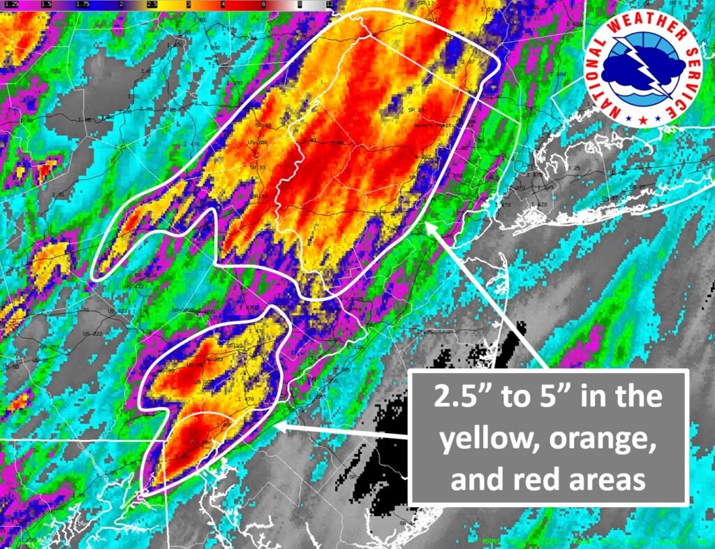
Strong storms brought severe winds and RADAR-indicated tornadoes to the region yesterday. The storms also brought heavy amounts of rain to the region. In Delaware, 4.63″ fell in Newark while 4.32″ fell in Wilmington. In Pennsylvania, Easton got 4.50″ while Martins Creek got 4.43″; Chadds Ford Township got 3.27″ while Exton got 3.93″ of rain. Some of the heaviest rain fell in New Jersey: Randolph got 5.38″, Chester Township got 4.64″, Andover for 4.67″, Pequest got 5.66″, and Belvidere got 5.18″.
The National Weather Service’s Storm Prediction Center (SPC) says that a midlevel trough with embedded perturbations and an associated surface cold front will move slowly eastward across New York and Pennsylvania and toward the Mid-Atlantic coast today. “Lapse rates, buoyancy and vertical have all been reduced compared to yesterday, in the wake of prior widespread convection and as the primary jet moves offshore. Still, slightly cooler midlevel temperatures and surface heating with residual moisture in cloud breaks could support isolated storms with gusty winds,” the SPC cautions.

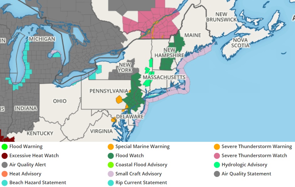
With the threat of more heavy rain, Flood Watches are in effect for large parts of New Jersey, eastern Pennsylvania, and northern Delaware.
The National Weather Service has also issued numerous Severe Thunderstorm Warnings for storms moving through Pennsylvania, New Jersey, Maryland, and even Washington DC as of press time. While no Severe Thunderstorm Watch is in effect, it’s possible additional Severe Thunderstorm Warnings or even Tornado Warnings could be issued throughout the day as storms pop-up. Yesterday’s storms had a greater tornado potential than today’s; today’s greatest threat from severe storms will be from damaging wind gusts.
The heaviest rain today will fall between 5 pm and 11 pm. The greatest threat of thunderstorms will be between 2 pm and 9 pm. Unstable conditions will linger into tomorrow with a slight chance of new scattered showers and storms on Wednesday. However, by Thursday, fair high pressure will finally return, bringing mostly sunny skies and pleasant, warm conditions back to the region.