The week is expected to end on a stormy note in the northeast; as such, the National Weather Service’s Storm Prediction Center has highlighted an area that could see severe thunderstorms. The National Weather Service cautions: when thunder roars, head indoors; lightning can kill. If a thunderstorm is close enough to be heard, lightning is close enough to kill.
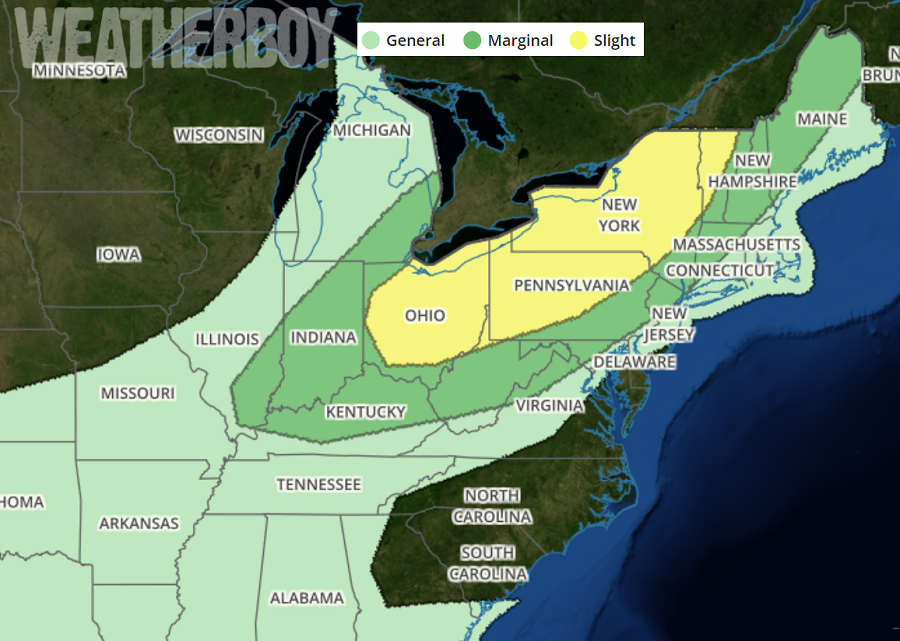
The Friday storms are being created as a mix of meteorological ingredients come together to support rain and thunderstorm activity. An upper high will remain situated over the Mid Atlantic, but heights will lower across the Northeast as a shortwave trough moves out of the Great Lakes during the day. Despite height falls aloft, mid-level temperatures will be quite warm and will limit instability, especially across New England where surface temperatures will be cool. An area of low pressure will pivot from eastern Ontario across Quebec, with a cold front extending from southwest Ontario into the Ohio Valley by Friday early evening. The main push with this front will clear New England overnight, reaching coastal areas by Saturday morning. Immediately ahead of the front, a moist air mass with mid to upper 60s dewpoints will exist, with the moist axis from the Ohio Valley into western New York by afternoon. The combination of sufficient instability and southwesterly winds will likely result in thunderstorms capable of locally damaging wind gusts in association with the cold front, mainly during the day, with a lessening threat overnight and with eastward extent.
On Friday, storms are expected to form along the front by midday, from southeast Lower Michigan into Indiana, and will then develop eastward across Ohio, Pennsylvania, and New York. The greatest risk of damaging wind gusts will be coincident with the instability axis which will be from the Ohio river into western Pennsylvania and New York during the afternoon. A storm or two may acquire rotation as well, from northwest Pennsylvania into western New York where low-level shear will be favorable coincident with the stronger instability. While this risk of rotation could spawn tornadoes, the threat risk is low. As the front pushes East late tomorrow night, the threat of severe weather will diminish.
