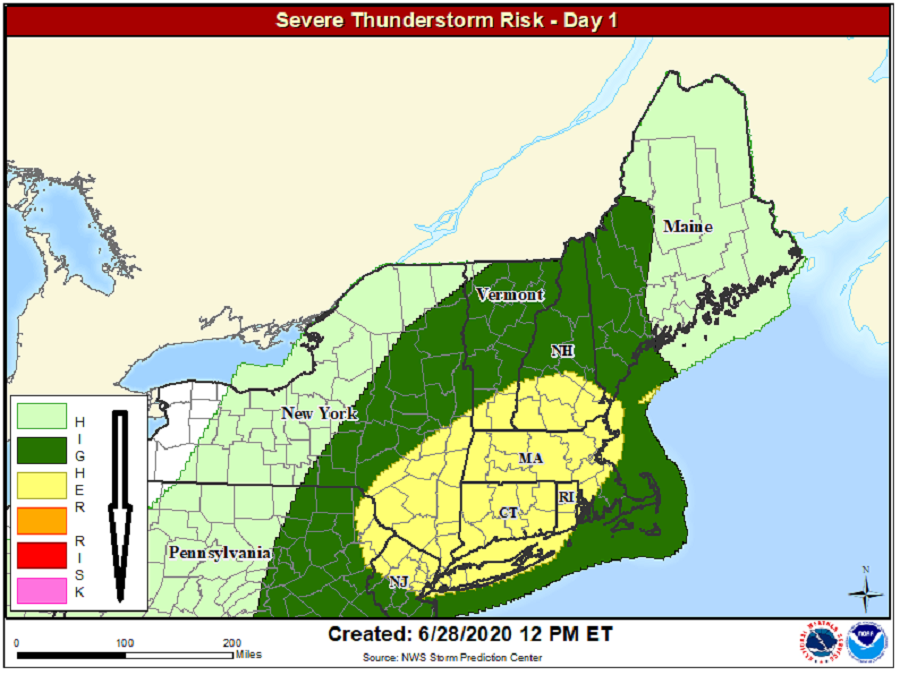
As afternoon heating continues today, severe thunderstorms are expected to fire-up across portions of the northeast. The greatest chance of severe thunderstorms today will be over northern New Jersey, northeastern Pennsylvania, southeastern New York including all of Long Island, all of Connecticut, most of Massachusetts, and most of Rhode Island.
Scattered thunderstorm development is underway across New York State, in association with a diffuse speed max rotating around the southern periphery of a closed low over Quebec, Canada. According to the National Weather Service’s Storm Prediction Center, storms will spread east-southeastward through the afternoon, as continued surface heating will boost atmospheric instability leading to more storms. Today’s atmospheric set-up will support multi-cell clusters and low-end supercells, resulting in damaging wind threats. There’s also a risk of large, damaging hail in such a scenario. While an isolated tornado or two can’t be ruled-out, this type of set-up isn’t very favorable for the formation of tornadoes.
Even non-severe thunderstorms can be dangerous: the National Weather Service cautions that lightning from any storm can be lethal. “When thunder roars, stay indoors,” the National Weather Service cautions, adding that if thunder is close enough to be heard, lightning is close enough to kill.
Beyond wind, hail, and lightning threats, storms could also drop heavy amounts of rain in a very short period of time, resulting in some flash flood issues.