A strong weather system is forecast to bring snow, rain, wind, and waves to portions of the U.S. East Coast tomorrow; while temperatures will soar ahead of the system, they are forecast to dramatically drop behind it, especially across the northern tier.
An area of low pressure is forecast to develop over the Texas Panhandle and Oklahoma by tomorrow morning before tracking northeastward along an attached cold front as it advances across the Mississippi Valley. As the advancing cold front clashes with the warm and moist airmass tonight, a line of thunderstorms is expected to develop across North Texas and Oklahoma. The potential exists for storms to produce damaging wind gusts, large hail, and isolated tornadoes in this region. The severe weather threat is expected to shift eastward along the cold front and into parts of the lower Mississippi Valley, Mid-South and Southeast on Thursday.
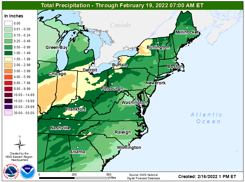
With plenty of moisture to work with, the threat of heavy rain also exists from parts of the Southern Plains to the Appalachians through Thursday night. There are expected to be two main modes of heavy rainfall that may lead to flash flooding; the first is associated with intense rainfall rates related to thunderstorms and the second is related to widespread heavy rain along the strong cold front. Both are expected to lead to widely scattered flooding concerns. Thunderstorm-induced heavy rain is most likely across the southernmost affected areas, particularly from the southern Plains to the southern Appalachians between Wednesday night and Thursday night. Farther north, flood watches are in effect from portions of southern Missouri, central Illinois, across much of Indiana into the eastern Great Lakes, where the combination of longer duration heavy rain along with melting snow is
expected to cause flooding concerns.
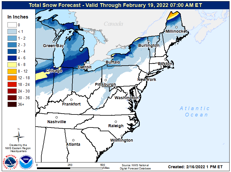
On the cold side of the system, a swath of potentially heavy snow is possible from northern Oklahoma to southern Michigan on Thursday, with wintry weather also clipping the northern tip of Maine by Friday morning. Gusty winds will also accompany this system, which will combine with snowfall to severely reduce visibility. A wintry mix, including areas of sleet and freezing rain, will likely fall just to the south of the heaviest axis of snow. Winter Storms Watches are in effect for the locations most likely to see significant snowfall or a combination of snow and a wintry mix. This includes far northern Oklahoma, eastern Kansas, northern central Missouri, north-central Illinois, northern Indiana, and southern Michigan.
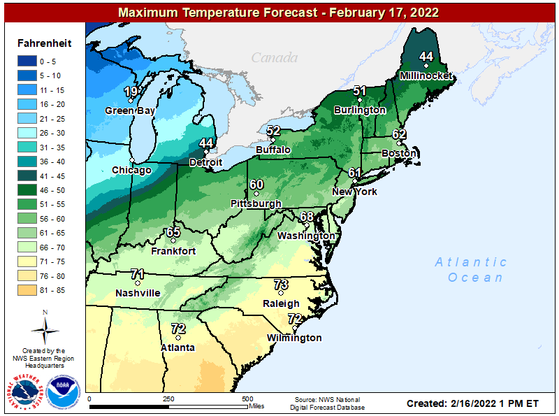
As the storm system heads east, milder air will surge up the coast. Highs will rise into the 70’s from central Virginia south; 80’s are possible as far north as central Georgia. Temperatures will also surge into the low to mid 50’s across northern New England, adding to the snow melt there.
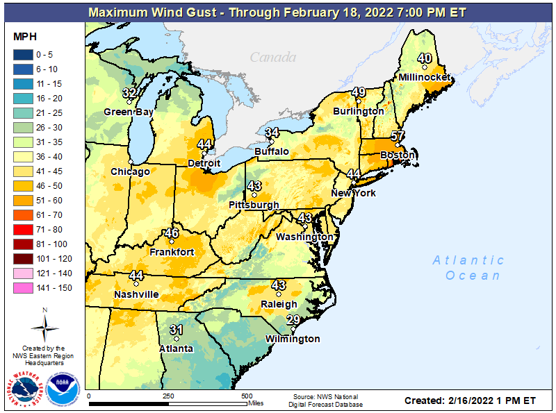
As winds rush up ahead of the frontal system and down behind it, they could reach damaging levels, especially at the immediate coast. In southeastern New England, winds are expected to gust to hurricane-force levels in the high 70 mphs. Winds will be breezy and strong across much of the eastern United States, with gusts to or over 40 mph expected in every state east of and including Michigan, Illinois, Kentucky, and Tennessee.
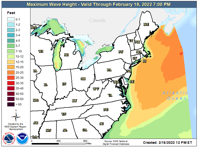
Strong winds will also kick up rough surf along the northeast coast. While the highest waves with heights over 25 feet will be off-shore, rough surf will pound the New England coastline, leading to possible coastal flooding or beach erosion conditions. People in areas susceptible to coastal flooding should monitor conditions and be prepared to head to higher ground if authorities suggest so.
With more mild air to work with than cold, most precipitation will fall as rain, especially in the Northeast and Mid Atlantic regions. However, some heavy snow is possible over extreme northern Vermont as colder air rushes in behind the frontal system.