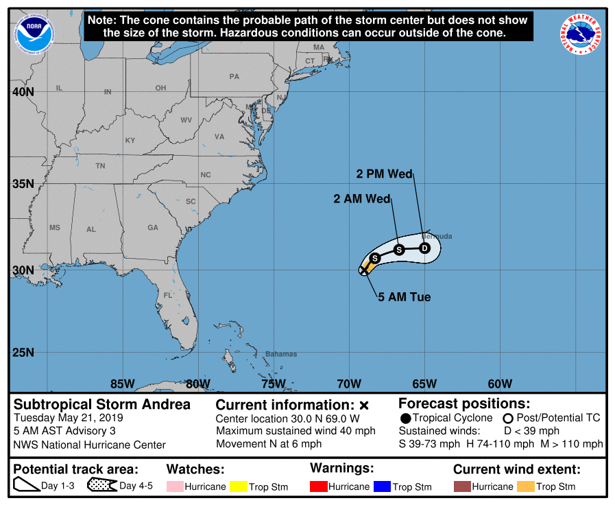
The first system of the 2019 Atlantic Hurricane Season, which arrived 11 days before the official start of the season, is forecast to fizzle before it has the opportunity to do much harm.
According to the latest National Hurricane Center (NHC) update this morning, the center of Subtropical Storm Andrea was located near latitude 30.0 North, longitude 69.0 West. The storm is moving toward the north near 6 mph and that general motion is expected to continue this morning. According to the NHC, a turn toward the northeast is forecast by this afternoon, followed by an eastward motion by late tonight and Wednesday. On the forecast track, the center of Andrea is expected to remain southwest and south of Bermuda during the next day or two.
Maximum sustained winds are near 40 mph with higher gusts. Little change in strength is forecast today, followed by weakening late tonight. Andrea is expected to dissipate on Wednesday, with its remnants merging with a frontal system moving across the Atlantic. It is unlikely that Andrea will become stronger than it is right now.
The estimated minimum central pressure is 1007 mb or 29.74 inches.
There are no watches or warnings associated with this storm anywhere at this time.