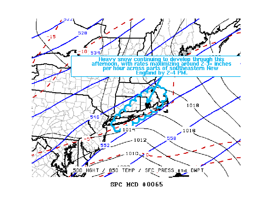
A snowstorm on this Super Bowl Sunday continues to race north and east, bringing snow at exceptionally heavy rates throughout portions of Pennsylvania, New Jersey, and New York. Meteorologists at the National Weather Service’s Storm Prediction Center are warning of very heavy snow bands likely to set-up over southeastern New England between 2-4 pm today, making travel difficult if not impossible.
With heavy bands of snow set-up over portions of New Jersey and Pennsylvania now, the National Weather Service in Mount Holly, New Jersey, responsible for these forecast areas, are warning of more snow which could exceed 10″ in places. They expanded the Winter Storm Warning to include upper Montgomery and upper Bucks Counties based on reports and radar trends.
Conditions went from rain to heavy snow in portions of southern New Jersey where up to a quick 4″ fell in as little as 2 hours. Additional snow is expected before the storm slides quickly north and east later this afternoon.
The Storm Prediction Center warns, “Heavy snow is in the process of developing, with hourly snow rates expected to maximize around to 2-3+ inches per hour by 2-4 pm across the Greater Providence and southern Greater Boston Metropolitan areas.
The rapid deepening of a surface cyclone is now underway to the east-northeast of the southern Mid Atlantic coast, as a jet streak, associated with a vigorous mid-level short wave impulse, noses across the North Carolina coast. This system is forecast to accelerate northeastward through this afternoon, with continued rapid deepening of the cyclone, and intensifying deep-layer frontogenetic forcing to its north-northeast.
Periods of heavy snow have already been observed within the developing frontal precipitation band across parts of southeastern Pennsylvania into the Greater New York City area, with increasing snow rates in the process of developing across Long Island and southern New England. As of 11:05am, White House Station in New Jersey was reporting 4.4″ while Ewing had 3″ at 10:51am. Middlesex County’s Edison was up to 3″ by 10:45am. Hillsborough Township in Somerset County reported 5″ as of 11:21am. In Pennsylvania, Bucks county had up to 8″ at 11am while Chester County had up to 8.8”. Even Delaware County, Pennsylvania’s Thornton was up to 3.1″ by 10:10am where earlier rain changed to plain snow.
As of of 1pm, the rain/snow line was near the Delaware/Maryland coast. South of this area, precipitation should remain rain while points north and east of there should remain plain snow for the duration of the storm. Very heavy snow was falling over central Delaware, Cape May County, New Jersey, southeastern Pennsylvania including Philadelphia, and much of interior southern New Jersey. This heavy snow will continue to race to the north east today.
Forecast guidance suggests some weak destabilization of the atmosphere may occur, especially over Long Island and southeastern New England. As such, convective activity in the form of thunder snow storms cannot be ruled out. Snowfall in these isolated convective bursts could exceed rates of 3″+/hour.
When snow falls at rates greater than 1″/hour, white out conditions could occur. With visibility dropped low, travel could become very difficult if not impossible. Travelers are advised to postpone travel until the heavy snowfall snow exits the region.
Snow will end from southwest to northeast in the Mid Atlantic by later this afternoon and by evening across southeastern New England.