The National Weather Service Office in Mount Holly, New Jersey has confirmed that a tornado touched-down in Friday’s severe weather outbreak in Monmouth County not far from the Jersey Shore; a storm survey reported that the tornado crossed the busy lanes of the Garden State Parkway after doing damage in one community and traveling to the next. Fortunately, no injuries were reported in the tornado.

On Friday, a frontal system partially responsible for setting the stage for this weekend’s unusually blast of summertime temperatures moved through the Mid Atlantic, prompting the National Weather Service to issue a Tornado Watch for portions of Pennsylvania, New Jersey, Maryland, and Delaware.
While that Tornado Watch was in effect, several severe thunderstorms marched across the region, including one cell which produced large hail of about 2.5″ diameter in Cherry Hill, New Jersey.
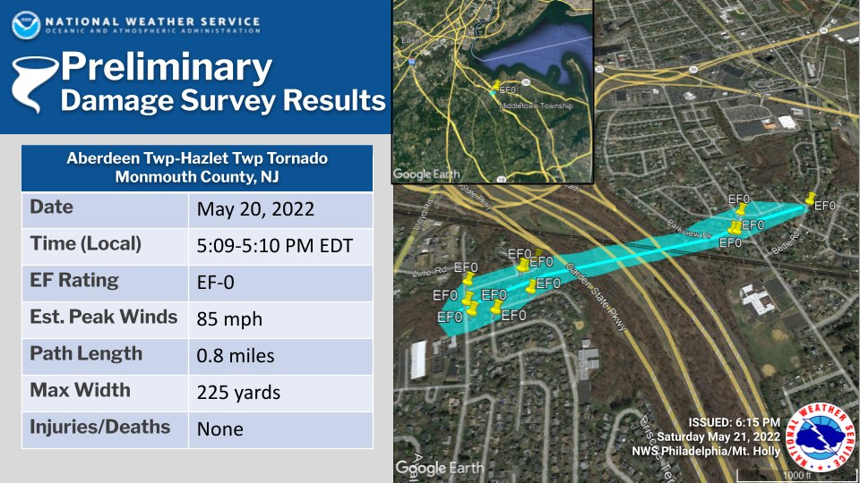
According to a Storm Survey Report just released by the National Weather Service (NWS), another violent cell within the severe thunderstorm event triggered a tornado touch-down in Hazlet Township just after 5 pm on Friday.
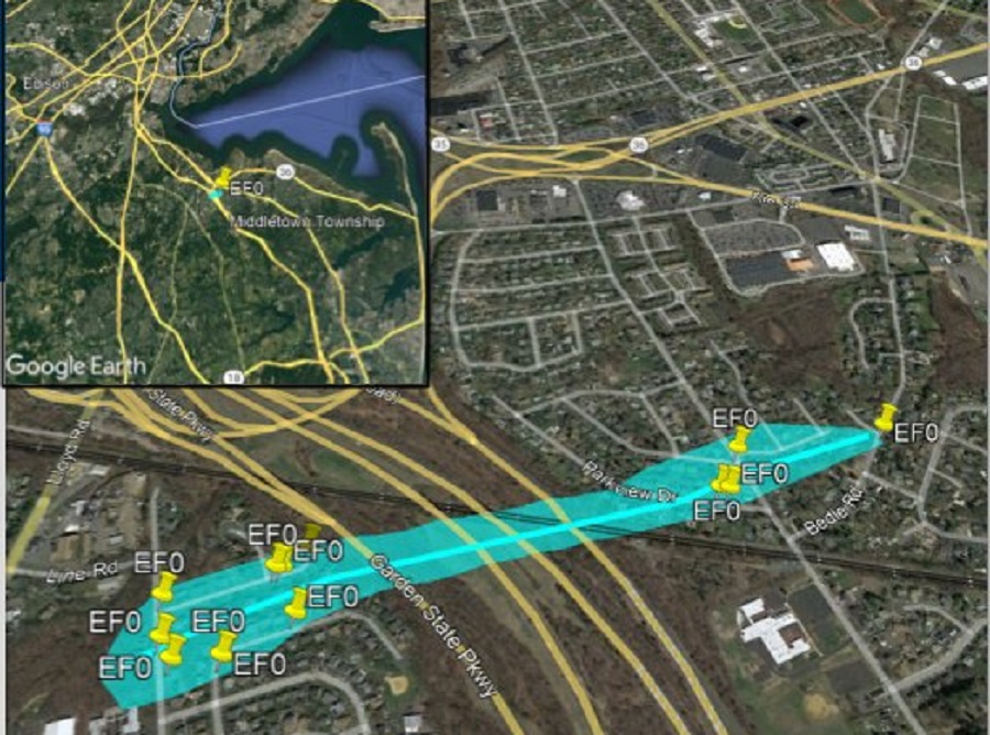
According to the NWS, the tornado began along Line Road on the border between Strathmore and Hazlet townships. There, several large limbs were blown off and a couple of softwood tree trunks were snapped. “The snapped tree trunks caused collateral damage to utility poles and power lines near the intersection of Sophia Drive,” the NWS added.
From there, the tornado traveled east-northeast into a residential neighborhood between Sophia Drive and Carlow Drive. There, the most significant damage from the tornado occured. According to the NWS, at least a dozen homes sustained cosmetic damage, including vinyl siding blown off, soffit damage, gutter damage, and/or roof shingles blown off. Within this area, the NWS observed only a single house with structural damage; there, a tree fell down onto a house, compromising its roof. Overall, a few larger softwood trees were uprooted in the residential area and several vinyl fence sections were blown over.
From there, the tornado crossed the Garden State Parkway into another residential area. The NWS says the tornado path became “somewhat discontinuous as it crossed” the major highway at roughly 5:10 pm. No reports of damage to vehicles on the Parkway have been shared as of publication time.
Once the tornado crossed the Garden State Parkway, it entered a new residential area along Park View Drive. There, a softwood tree sustained significant loss of limbs and a couple of others were uprooted in the area. A utility pole was also damaged along Park View Drive. A few homes sustained minor cosmetic damage near the intersections of Linda Place, Beers Street, and Rutgers Street.

From Rutgers Street, the storm moved towards Bedle Road where several large limbs were blown off of trees. According to the NWS, a final softwood tree was uprooted along Bedle Road near Indian Hill Court where the tornado appears to have dissipated.
While the tornado dissipated, the severe thunderstorm didn’t. While no additional damage occurred from this storm as it continued through the residential area toward Route 35, 4 utility poles were pushed over or broken along Route 35 near a Jiffy Lube Auto Shop. Because there was no other additional damage in the area, the NWS determined this additional damage was due to straight line winds and not tornadic winds.
The entire tornadic episode in Hazlet on Friday was very short-lived. According to the NWS, the event started at 5:09 pm and wrapped up by 5:10 pm. No Tornado Warning was issued, but with the Tornado Watch in effect, residents should have been prepared for tornadic cells in the region.
Overall, the tornado had estimated peak winds of 85 mph, making it a EF-0 rated tornado on the Enhanced Fujita tornado scale. The Enhanced Fujita Scale or EF Scale, which became operational on February 1, 2007, is used to assign a tornado a ‘rating’ based on estimated wind speeds and related damage. When tornado-related damage is surveyed, it is compared to a list of Damage Indicators (DIs) and Degrees of Damage (DoD) which help estimate better the range of wind speeds the tornado likely produced. From that, a rating (from EF0 to EF5) is assigned. In general, EF-0 tornadoes have 65-85 mph winds, EF-1 have 86-110 mph winds, EF-2 have 111-135 mph winds, EF-3 have 136-165 mph winds, EF-4 have 166-200 mph winds, and EF-5 tornadoes have winds in excess of 200 mph. The EF Scale was revised from the original Fujita Scale to reflect better examinations of tornado damage surveys so as to align wind speeds more closely with associated storm damage., with the new scale related to how most structures are designed.

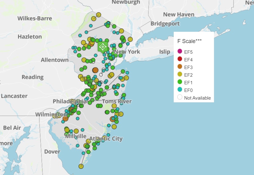
According to the NOAA, in the period from 1950 to now, there have been a total of 183 reported tornado touch-downs in New Jersey, responsible for 80 injuries, 1 death, and more than $84 million in property damage. In a typical year, New Jersey will see 2-3 tornadoes. However, while the overall volume of severe storms and tornadoes has trended down significantly across the entire United States, the opposite has been occuring in New Jersey. In 2019 10 tornadoes were recorded while in 2020 the number dropped to 4; however, the number rose again to 13 in 2021.