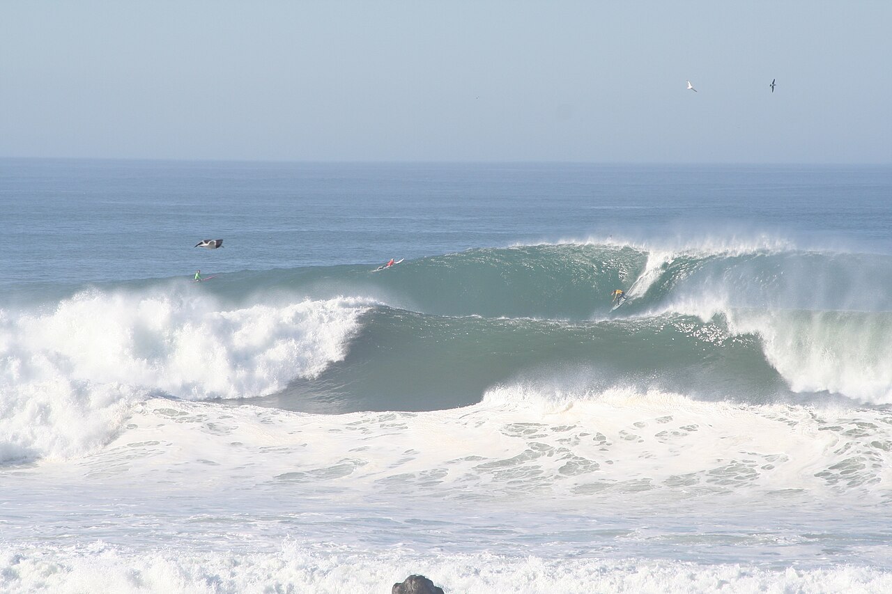
Towering surf crashed ashore along the U.S. West Coast Saturday, prompting evacuation warnings for low-lying neighborhoods in Santa Cruz County, beach and road closures on the Monterey Peninsula and a coastal flood warning along the Central Coast as forecasters warned that anyone who ventured near the water risked being swept away.
Fresno television station KMPH called the swell some of the biggest waves to reach California in a few years.
The National Weather Service office in the San Francisco Bay Area said breaking waves of 25 to 35 feet were expected along the Pacific coast Saturday, with occasional sets of 40 to 50 feet likely at favored breaks such as Mavericks near Half Moon Bay. A High Surf Warning was in effect there until 4 a.m. Sunday.
“These waves bring tremendous power that will overpower anyone in the water and cause coastal erosion,” the weather service said in its forecast discussion. “The risk of drowning is very high this weekend. Do not go in the water, avoid climbing on the rocks or leaning over seawalls, and never turn your back on the ocean.”
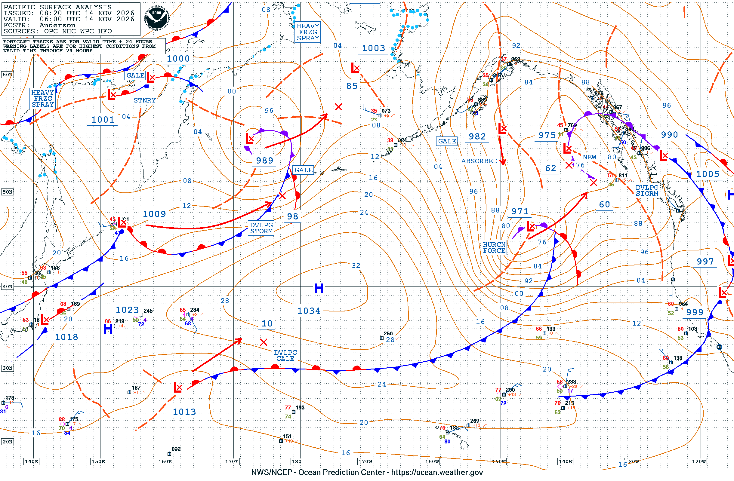
The swell was generated by a series of powerful low-pressure systems over the northeastern Pacific. The weather service’s Bay Area office described them as “hurricane force” storms, and the Ocean Prediction Center’s surface analysis early Saturday labeled a low off the Pacific Northwest as producing hurricane-force winds.

Buoys Show the Swell Arriving
Offshore buoys recorded the energy as it reached the coast. A buoy west of San Francisco measured waves of 34.1 feet Friday afternoon, passing about every 19 seconds, according to the weather service, as reported by SFGate. Long intervals between waves are a sign of a powerful, long-traveled swell that can surge farther up beaches than people expect.
Early Saturday, the National Data Buoy Center’s Bodega Bay buoy, station 46013, reported significant wave heights of about 28 feet with a 19-second dominant period at 3:20 a.m. PST. The San Francisco buoy, station 46026, reported about 20 feet with the same period shortly before 4 a.m.
The weather service’s Eureka office said a “very large NW swell of 27 to 30 ft at 18 seconds” arrived late Friday and early Saturday and would peak early Saturday, with seas remaining above 18 feet through Saturday evening.
Evacuation Warnings in Santa Cruz County
The Santa Cruz County Sheriff’s Office and the Capitola Police Department issued evacuation warnings at 2 p.m. Friday for several low-lying coastal zones: Capitola Village, the Esplanade and the Venetian; the Las Olas Drive and Beach Drive area of Rio Del Mar in Aptos, including Platform Beach; and the Potbelly Beach and New Brighton State Beach area.
An evacuation warning means residents should be ready to leave and should consider going early, particularly if they need extra time or have pets or livestock. No evacuation orders had been issued as of the county’s most recent online update, which was posted Friday afternoon.
“Large waves have the potential to reach coastal homes and properties, causing dangerous flooding and making access to affected areas difficult or unsafe,” the sheriff’s office said, as reported by SFGate. “Residents should not wait for conditions to worsen before considering leaving.”
The county urged residents not to return to the coast when conditions calm Sunday because a second swell was expected Monday. It also said water levels could run higher than normal this season. It said El Niño was raising sea levels along the coast and that some beaches had less sand than usual, allowing waves to reach farther up the shore.
Monterey Peninsula Closures
In Monterey County, public safety agencies closed a long list of beaches and coastal turnouts from Friday evening until Sunday morning, “with a very likely extension through Tuesday,” according to a release posted by Caltrans District 5 on behalf of the county. Closures included San Carlos and McAbee beaches in Monterey, coastal turnouts in Pacific Grove, beaches and turnouts in Pebble Beach, Carmel River State Beach, Garrapata Beach, Point Lobos State Natural Reserve and Asilomar State Beach.
SFGate reported that 17-Mile Drive in Pebble Beach was closed to visitors and, in some places, to residents.
Coastal flood warning on the Central Coast
Farther south, the weather service office in Los Angeles/Oxnard issued a Coastal Flood Warning for San Luis Obispo County beaches and the Central Coast beaches of Santa Barbara County from 3 a.m. to 6 p.m. Saturday. A High Surf Warning there called for “dangerously large breaking waves of 18 to 25 feet” until 3 a.m. Sunday.
The office said there was a high risk of seawater flooding low-lying coastal areas, especially around high tide, including “significant flooding of coastal beaches, walkways and roads, and potentially damaging some structures.” It said widespread flooding was likely in low-lying areas such as Oceano Dunes and that breaking waves could hit the Cayucos and Pismo Beach piers and the Morro Bay Harbor entrance.
The San Luis Obispo Tribune reported that the Pismo Beach Pier was closed because of the warning. Fresno television station KMPH reported that the pier and Oceano Dunes were closed Saturday but could reopen Sunday.
Coastal flood advisories also covered beaches from San Francisco to Monterey Bay and parts of Ventura, Los Angeles, Orange and San Diego counties Saturday.
Oregon and Washington Beaches
The surf was just as dangerous to the north. The weather service in Medford, Oregon, warned of breaking waves of 30 to 35 feet Saturday morning along the south-central Oregon coast and the Curry County coast, including Charleston, Port Orford, Gold Beach and Brookings. Waves were forecast to fall to 20 to 25 feet by evening before building again to 25 to 30 feet Sunday night.
“Waves will inundate beaches and surge into normally dry areas,” the warning said. “Infrastructure damage and significant beach erosion can be expected.”
The weather service in Eureka, California, warned of breaking waves of 30 to 40 feet along the Del Norte, Humboldt and Mendocino coasts until 4 a.m. Sunday. In Portland, Oregon, forecasters warned of breakers up to 30 to 35 feet on the north and central Oregon coast and the south Washington coast until noon Saturday and said sneaker wave danger was “extreme.”
The Seattle office said logs and debris that piled up on beaches and jetties during high surf last weekend posed an added threat on the Washington coast.
Coast Guard Urges Caution
The U.S. Coast Guard said Friday that it was prepared to respond as hazardous conditions affected the California coast through Sunday morning.
“Mariners and beachgoers should monitor Coast Guard and National Weather Service updates, never turn their backs on the ocean, wear life jackets, and carry reliable communications equipment,” said Lt. John Corvino, a search and rescue mission coordinator with Coast Guard Sector San Francisco.
As of early Saturday, no deaths, injuries or rescues tied to the surf had been reported in the official sources reviewed for this story.
What Comes Next
Forecasters said the break would be short. In the Bay Area, a second frontal system is expected Sunday into Monday with a half-inch to 1 inch of rain in many areas, and a third, possibly stronger storm could arrive Tuesday through Thursday. The office said flooding concerns would grow as soils become saturated and creeks reach bankfull.
On the Central Coast, the Los Angeles/Oxnard office said warning-level surf could return late Sunday night through Monday, and the Eureka office said a second large swell was forecast late Sunday through Monday.
Officials said the safest choice is to avoid the coast entirely and not to approach the shoreline to watch or photograph the waves.
