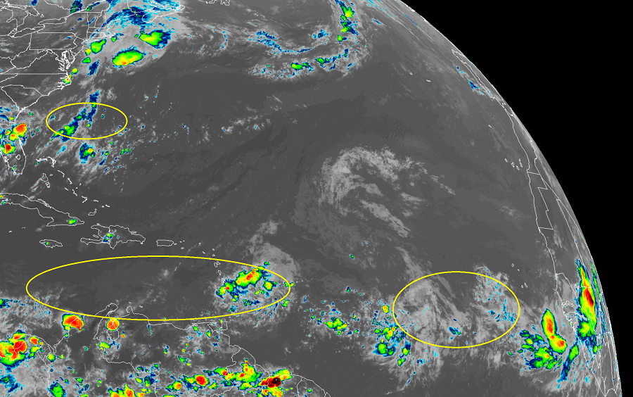
While there are no named tropical cyclones in the Atlantic hurricane basin today, that could change in the coming days. The National Hurricane Center (NHC) based in Miami, Florida is tracking three areas of disturbed weather that could evolve into tropical cyclones with time.
The first is a tropical wave located about 550 miles east of the Windward Islands. Today, this tropical wave is producing disorganized showers and thunderstorms. According to the NHC, some gradual development of this system is possible during the next several days while it moves westward at about 15 mph toward theLesser Antilles. Regardless of development, this system will likely produce gusty winds and locally heavy rainfall across portions of the Windward and Leeward Islands on Sunday. While tropical cyclone formation is possible here, the odds aren’t high; the NHC says there’s only a 20% chance of formation over the next 48 hours and 30% chance over the next 5 days.
The second is another tropical wave located over the eastern Atlantic Ocean just southwest of the Cabo Verde Islands. This system is expected to move very slowly for the next several days, and some development is possible early next week over the eastern or central tropical Atlantic. While there’s no chance of development over the next 48 hours, the National Hurricane Center says there’s a medium chance that a tropical cyclone will form here over the next 5 days, increasing odds to 40%.
The third area of concern is off the U.S. southeast coast. According to the NHC, a low pressure area is expected to form off of the southeastern coast of the United States early next week. Additional subsequent development is possible as the system moves east-northeastward
across the northwestern Atlantic Ocean. Of the three systems being observed, this has the lowest odds of becoming a tropical cyclone over the next 5 days; the NHC pegs those odds at only 20% now. Even if a system were to form, it would not impact the U.S. East Coast.
