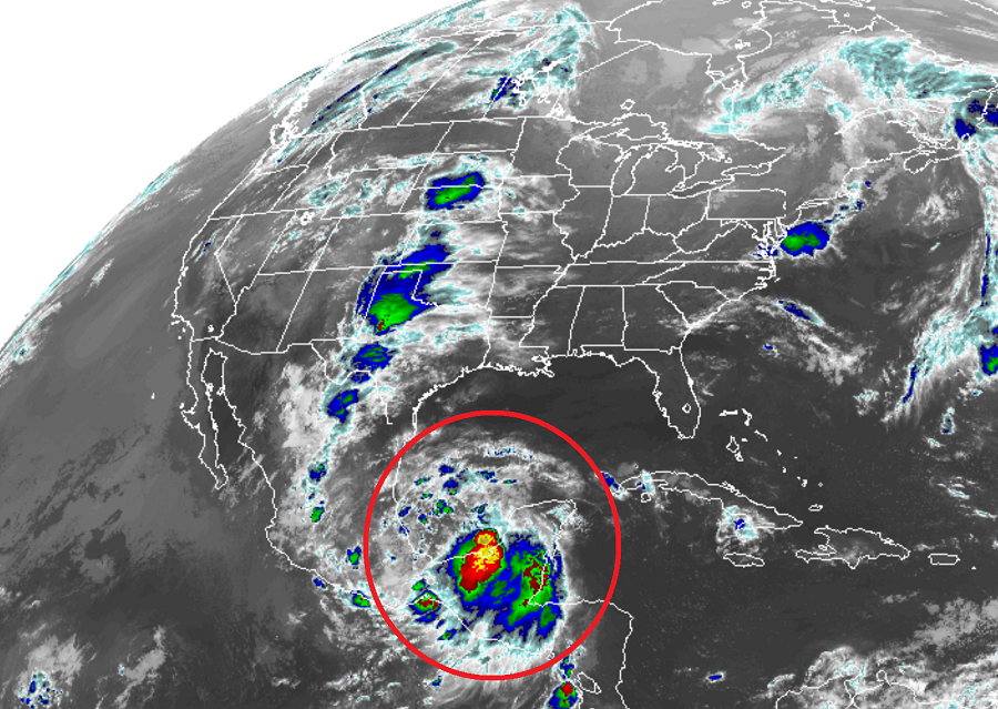
Meteorologists continue to track an area of disturbed weather in the southern Gulf of Mexico for possible tropical cyclone development. According to the National Hurricane Center, showers and thunderstorms have increased since yesterday in association with a broad area of low pressure over the Bay of Campeche. However, recent satellite wind data show the low does not have a well-defined circulation. This system is expected to move slowly northwestward toward the northeastern coast of Mexico, and may become a tropical cyclone before it moves inland in a day or two.
At this time, the National Hurricane Center believes there’s a 60% chance that a tropical cyclone will form here prior to it interacting with land. The National Hurricane Center does urge caution though: regardless of development, the disturbance will likely produce heavy rainfall over portions of southern and eastern Mexico during
the next few days.
An Air Force Reserve reconnaissance aircraft will investigate the disturbance this afternoon, if necessary.
The National Hurricane Center says that interests along the Gulf coast of Mexico should monitor the progress of this system. Because remnant moisture could impact Texas, residents there should also be aware of its future track.
