The National Weather Service’s Storm Prediction Center is tracking the potential for severe thunderstorms on Tuesday. Amid a modestly strong belt of mid-level westerlies, multiple east/southeastward-moving clusters of storms and small-scale mid-level disturbances are traveling to the east from the Great Lakes region. While overall atmospheric forcing will generally remain subtle, outflows and the aforementioned mid-level perturbations should contribute to an increase in thunderstorm coverage and intensity within a relatively moist and increasingly unstable air mass this afternoon. This atmospheric instability will create clusters of thunderstorms, some of which will reach severe limits and contain damaging wind gusts. While some severe storms could produce large hail or an isolated tornado, it appears today’s top threat will be those damaging wind gusts. Most of the thunderstorm activity today will exist during the late afternoon and evening hours.
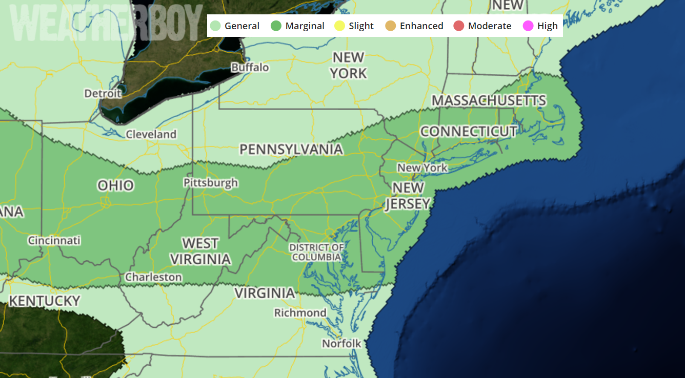
The Storm Prediction Center has issued a Convective Outlook showing an elevated risk of severe storms across portions of the Mid Atlantic and southern New England areas. The best chance for severe weather today in this region will be across southern and eastern Pennsylvania, northern Virginia, all of Maryland, Delaware, New Jersey, Connecticut, and Rhode Island, southeastern New York including New York City and Long Island, and eastern Massachusetts including the Cape and nearby islands. However, people in this area should remember: when thunder roars, head indoors. Whether a storm is severe or not, lightning can kill.
While the threat of weather will subside for Wednesday, a new threat will arrive on Thursday with a new frontal system in the region.
