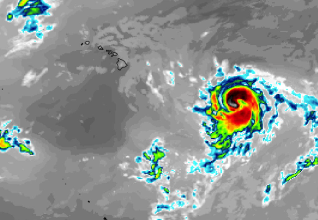
Global computer forecast models are suggesting that a tropical cyclone could impact Hawaii early next week, bringing much needed rainfall to a state dealing with severe drought. However, a tropical cyclone, whether it be a direct hit or a near-miss from a hurricane or tropical storm, could also be damaging, bringing too much rain too quickly setting the stage for flooding and rockslides, as well as threats from wind damage and storm surge flooding.
In this morning’s Forecast Discussion, forecasters at the Honolulu, Hawaii office of the National Weather Service wrote, “There remains a large degree of uncertainty in the wind and weather patterns heading into next weekend due to potential tropical cyclone activity in the Central Pacific, east of Hawaii. The National Hurricane Center is forecasting a high chance of tropical cyclone development in the East Pacific over the next seven days with westward movement into the Central Pacific by the end of next week.” They add, ” However, the GFS and ECMWF long-range model guidance differ significantly in the existence, position, and strength of activity near Hawaii.”
Global computer models such as the American GFS , the German ICON , the Canadian CMC, and the European ECMWF all show different scenarios with how a developing tropical cyclone could impact Hawaii. The GFS suggests a tropical storm or hurricane taking shape south and east of the islands this weekend and then moving north and west along the east coasts of the islands before crossing Hawaii near Oahu as a much weaker tropical cyclone. The ICON also calls for a tropical storm or hurricane to take shape and approach the Big Island of Hawaii for a direct hit. While the ICON reflects a direct-hit scenario, it also weakens the tropical system prior to landfall. The ECMWF keeps the tropical cyclone the strongest of the models, but also keeps its center of circulation south of the state, brushing the islands with wind-whipped heavier rain showers to its north. The Canadian CMC has the storm the weakest of the models, but also has it moving the quickest. Like the ICON, it brings the system on collision course with the Big Island of Hawaii. All models do bring rain to Hawaii, but the amount will be based on the actual track that materializes.

It is still far too soon to say with any degree of certainty which forecast model is right, but as the National Weather Service pointed out, the active tropics will need to be carefully monitored in the coming days to see what in the Central Pacific takes shape and where it heads.
Should a tropical cyclone become a tropical storm in the Central Pacific basin, it would be given a Hawaiian name: Hone.
As with the Atlantic Hurricane Season, the Central Pacific Hurricane Season, of which Hawaii is a part of, runs from June 1 to November 30.
“The time to take action and commence preparations for your family, business, and property is when you are informed there is a possibility that hurricane hazards may affect your area,” writes Hawaii County Civil Defense.” They urge people to develop a family and business emergency plan that includes transportation readiness, evacuation routes and timing, details to secure homes and businesses, and know what to do with pets and animals prior to potential impacts.
“If you own a boat or small aircraft, take actions to safeguard your crafts and complete your actions before damaging surf or winds arrive. All coastal areas will be closed during the storm and roadways can be blocked by debris without warning,” Civil Defense adds.
Civil Defense also encourages people to develop a home survival kit and an evacuation kit. “You can assume that if a hurricane strikes your area, all utilities will be affected. Be ready to cope with loss of water, electricity, gas, and telephone service…Know your area and prepare evacuation plans if your home may be endangered by high surf, flood, or winds. Be prepared to evacuate before the danger arrives.”
Hawaii County Civil Defense says two types of residents should evacuate for a hurricane impact. The first are residents along coastal areas, where they should use tsunami evacuation maps as a guideline. The second are residents that live along ridge lines exposed to strong winds.
“Stay calm, stay alert, and stay informed. Listen to official announcements by Civil Defense and the National Weather Service,” Civil Defense advises.
Authorities recommend that people have enough food, water, medicines, pet food, and fuel to last three weeks. Due to the potential of storm impacts to harbors or airports which could make bringing supplies into Hawaii difficult, authorities say those in Hawaii to be better stocked than those facing tropical cyclone threats on the U.S. mainland.