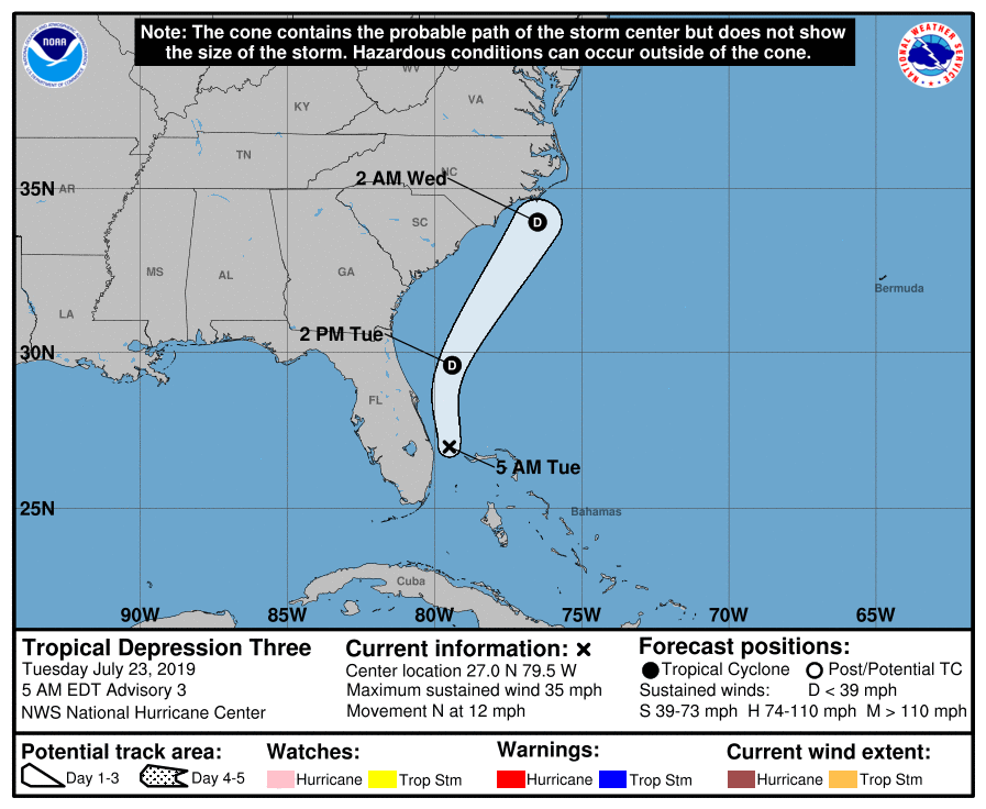
The center of Tropical Depression #3 continues to travel between the Bahamas and Florida’s east coast; while rough surf and some heavy rain showers are possible, the system is of little concern. In the last advisory from the National Hurricane Center (NHC), the center of Tropical Depression Three was located near latitude 27.0 North, longitude 79.5 West.
At this time, the depression is moving toward the north near 12 mph and this general motion is forecast to continue through this afternoon. The NHC predicts that the system will continue with a north-northeast direction with an increase in forward speed tonight; tomorrow a turn toward the northeast is expected. On the forecast track, the center of the depression should remain offshore the coast of the southeastern United States through Wednesday.
Additional intensification is not forecast by the NHC and Tropical Depression #3 is not expected to become a named tropical storm. For now, maximum sustained winds have increased slightly to near 35 mph with higher gusts. Rather than gain strength over time, the NHC is forecasting that this depression will dissipate on Wednesday.
The estimated minimum central pressure is 1012 mb or 29.89 inches.
In addition to the threat of rip currents off the southeast coast, heavier rain showers will be the primary concern. Rainfall of 1-3″ is possible across the Bahamas from this system today.