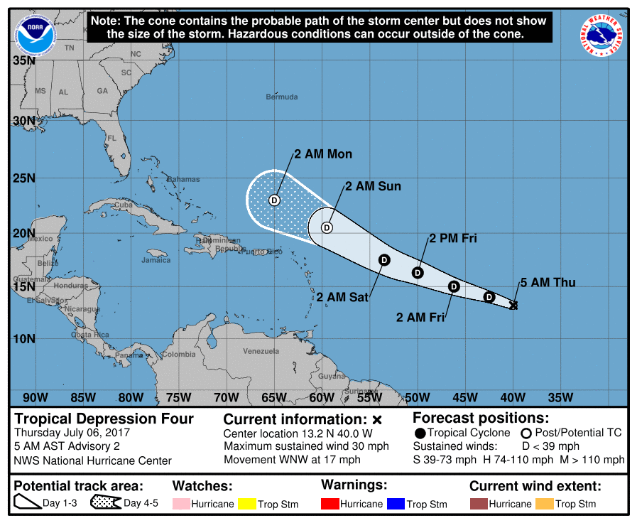
Tropical Depression #4, the latest tropical system of the 2017 Atlantic Hurricane Season, continues to head west today. In the latest advisory from the National Hurricane Center (NHC), the system was located near 13.2N and 40.0W and heading to the west-north-west at 17mph.
The National Hurricane Center originally forecast for this system to become a tropical storm over time. However, an abundance of dry air and dust from the coast of Africa have hampered any significant development of this system.
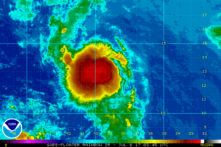
In this morning’s satellite presentation, the cloud pattern of the tropical cyclone consists mainly of a circularly shaped mass of deep convection that has persisted overnight. Since there has been little overall change in the
satellite appearance of the system, the current intensity estimate remains the same as it did last night when advisories on the tropical depression began.
Dry and dusty air related to the Saharan Air Layer, to the east of the tropical cyclone, is beginning to wrap around the northern part of the depression’s circulation. Dynamical models indicate that this air mass will be partially entrained into the system over the next couple of days. This, combined with increasing vertical shear, should prevent significant strengthening of the system. Although various computer models forecast some modest intensification of the tropical cyclone, the NHC believes the cyclone’s intensity will remain steady for a couple of days followed by weakening to a remnant low in 72 hours and dissipation after 96 hours.
If the storm manages to strengthen to a tropical storm before it dissipates, it would be named Don. If the storm never reaches tropical storm status, the name Don will be reserved for the next system that does.
According to the NHC, the center is not very easy to locate, but based on continuity with earlier data it is believed to be near the eastern edge of the convective mass. The flow on the southern side of a subtropical ridge should continue to steer the tropical cyclone, or its remnants, west-northwestward over the next few days. The official track forecast follows a trajectory very similar to the previous one, but is somewhat faster. This is close to the latest model consensus.
Extended range forecast guidance continues to bring this system, or its remnants, close to the US coast in about a week to a week and a half. While forecasts show this system as a disorganized area of convection, it could enhance heavy rainfall along portions of the east coast if its remnants track that far west.
