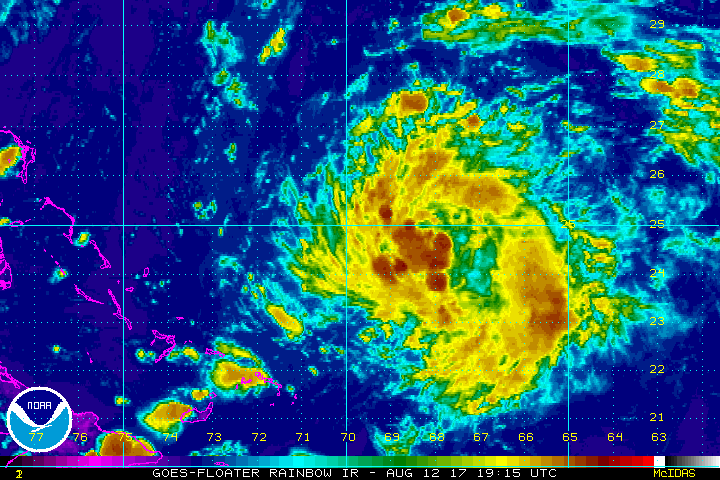
Tropical Depression #8 has formed, according to the National Hurricane Center (NHC.) Late afternoon GOES-16 visible satellite images showed that the circulation associated with the low pressure located northeast of the Bahamas had become better defined. Since that time, the
night-time microphysics RGB product and other infrared satellite pictures have continued to show an improvement in the circulation, and recent ASCAT data show that the system has acquired a well- defined center. Deep convection is organized in a large curved band, however the center is located near the western edge of the band. The NHC reports that a NOAA buoy located southeast of the center reported 25 to 30 kt winds earlier this evening, and the scatterometer data support an initial wind speed of 30 kt.
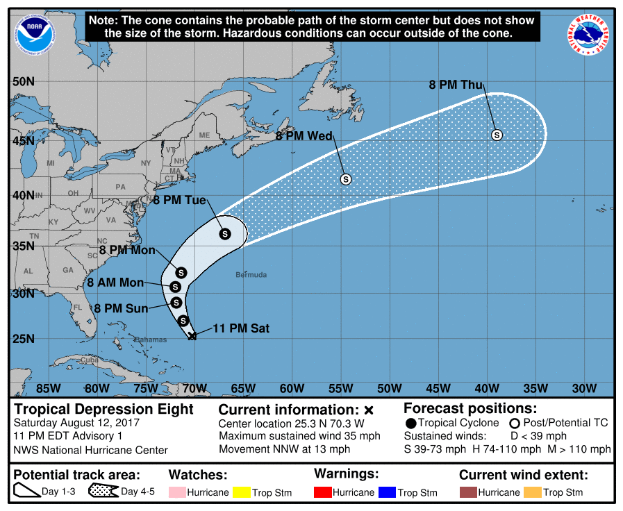
While it looks like this tropical cyclone is on a collision course with the East Coast of the United States, the weather pattern should steer it out to sea. The depression is moving north-northwestward at this time and the depression should move north-northwestward to northward around the western side of a deep-layer ridge over the central Atlantic through Sunday night. It is expected to reach the mid-latitude westerlies by late Monday and begin to accelerate northeastward ahead of a short-wave trough that will be approaching the northeastern United States.
While the track is clear, the intensity forecast isn’t. The system is expected to pass over warm water and remain in a low-shear environment during the next day or so, but intrusions of dry mid-level air are likely to limit strengthening. Some computer guidance suggests a period in which the storm will gain significant strength, while others aren’t nearly as robust. The NHC forecast is currently an average of those intensity forecasts. While the system will gain strength in the short term, it is likely to become extratropical in 3 to 4 days.
Experts believe this Atlantic Hurricane Season, which runs through to the end of November, will be a busy one. Dr. Phil Klotzbach and the experts at Colorado State University updated their seasonal outlook again on July 5, showing a much more active than normal season expected. The National Oceanic and Atmospheric Administration (NOAA) also released their own forecast which shows this hurricane season to be likely more active than others.
