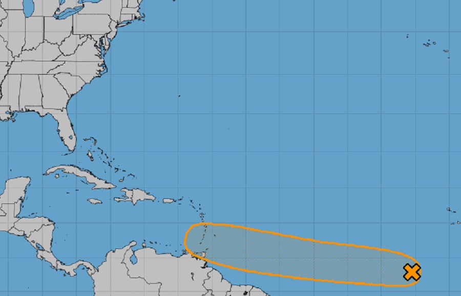
The National Hurricane Center is tracking a tropical disturbance in the eastern North Atlantic; it is expected to grow and form into a tropical cyclone in the coming days as Hurricane Season continues. The season, which began on June 1, has been off to a slow-start. During the first week of June, Tropical Storm Alex took shape; it soaked Florida with very heavy rain before officially becoming a tropical storm in the Atlantic; it then brushed by Bermuda and went out to sea. There have been no other tropical cyclones in the basin since then.
Today, the NHC’s attention is focussed on a tropical wave located over the eastern tropical Atlantic. This new disturbance is producing a large area of disorganized showers and thunderstorms. According to the NHC, environmental conditions appear conducive for development of this system over the next few days, and a tropical depression could form during the early to middle part of next week while it moves westward at 15 to 20 mph over the tropical Atlantic and approaches the Windward Islands. While there’s only a 20% chance of tropical cyclone formation over the next 48 hours, the NHC raises those odds to 60% over the next 5 days.
It remains too soon to know where this system would go beyond the Windward Islands with time.
Elsewhere, there are no areas of concern the NHC is tracking in the Atlantic hurricane basin for potential tropical cyclone development.