A tropical disturbance located just off the U.S. East Coast is being monitored closely by the National Weather Service and the National Hurricane Center for any signs of development. With the Atlantic hurricane season in full-swing for the next 7 weeks, it is possible a tropical cyclone could form near the U.S. coast before the season comes to a close.
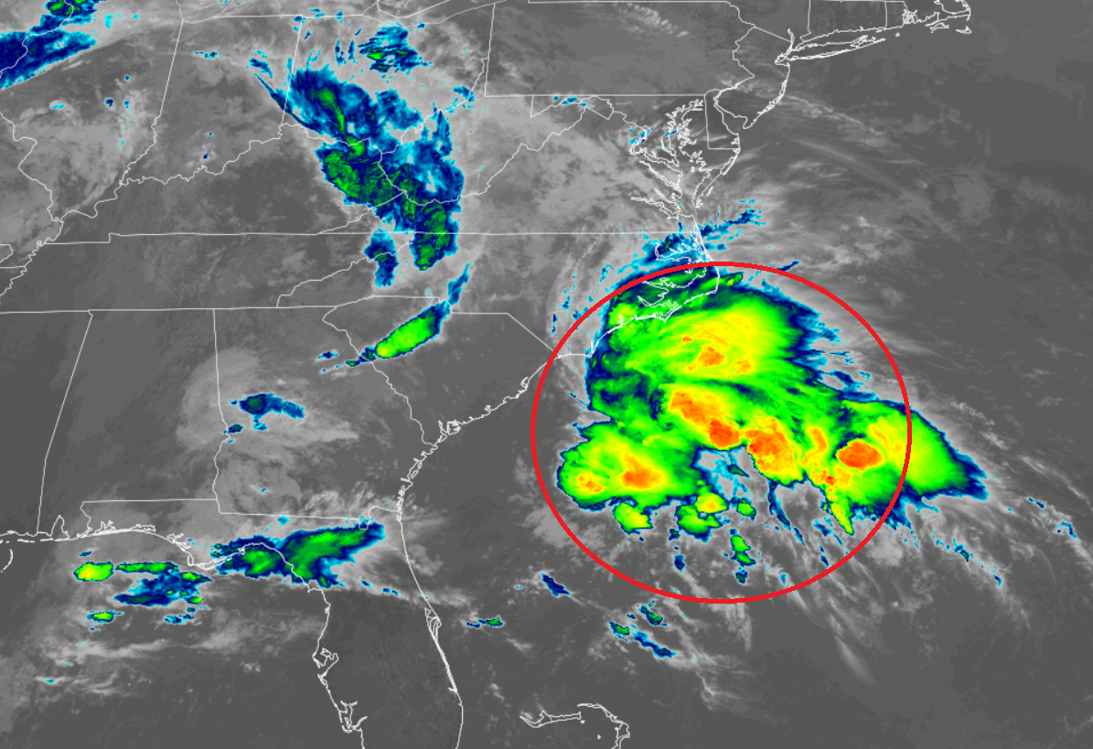
According to the National Hurricane Center (NHC) in Miami, Florida, a weak area of low pressure located about 100 miles off the coasts of Georgia and South Carolina continues to produce disorganized showers and thunderstorms, well to the northeast of the center of
circulation. It is this area of showers, storms, and clouds that is being monitored for development into a tropical depression or tropical storm.
The NHC says that strong upper-level winds should limit significant tropical or subtropical development during the next few days while the low moves northeastward at about 5 mph off the coasts of the Carolinas. However, they add that some non-tropical development will be possible over the weekend due to the system interacting with a frontal boundary.
Even if the system doesn’t develop into a full-blown tropical cyclone, it could bring gusty winds and locally heavy rain to portions of the Mid Atlantic through to the weekend.
