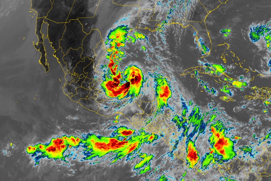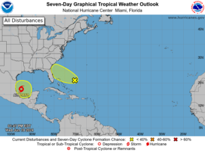
Potential Tropical Cyclone One was upgraded to Tropical Storm Alberto today by the National Hurricane Center (NHC.) While Alberto is moving west over the western Gulf of Mexico, bringing heavy rains, coastal flooding, and gusty winds to the the coasts of Texas and northeastern Mexico, the NHC is also monitoring a disturbance well off the southeastern U.S. coast which could grow into a tropical cyclone over time too.
For now, Tropical Storm Alberto is located about 180 miles east of Tampico, Mexico and about 295 miles south-southeast of Brownsville, Texas. Maximum sustained winds of the tropical storm are 40 mph while the minimum central pressure is down to 995 mb or 29.39 inches. The storm is moving to the west at 9 mph.
With the storm approaching land, a Tropical Storm Warning is in effect for the Texas coast from San Luis Pass southward to the mouth of the Rio Grande as well as the northeastern coast of Mexico south of the mouth of the Rio Grande to Tecolutla. A Tropical Storm Warning means that tropical storm conditions are expected somewhere within the warning area.
Currently, the NHC expects Alberto to reach the coast of northeastern Mexico early Thursday morning. Some slight strengthening is forecast today or tonight before the center of Alberto reaches land. Rapid weakening is expected once the center moves inland, and Alberto is likely to dissipate over Mexico Thursday or Thursday night.
However, Alberto is a large tropical storm, with tropical-storm-force winds extending outward up to 415 miles north of the center. While the storm center will move into Mexico, its impacts will be felt far north along much of the Texas coast. Tropical Storm Alberto is expected to produce rainfall totals of 5-10″ across northeast Mexico into South Texas. Maximum totals around 20″ are possible across the higher terrain of the Mexican states of Coahuila, Nuevo Leon, and Tamaulipas. This rainfall will likely produce considerable flash and urban flooding along with new and renewed river flooding. Mudslides are also possible in areas of higher terrain across northeast Mexico.
The combination of a dangerous storm surge and the tide will cause normally dry areas near the coast to be flooded by rising waters moving inland from the shoreline. The water could reach the following heights above ground somewhere in the indicated areas if the peak surge occurs at the time of high tide:
Sargent, TX to Sabine Pass, TX: 2-4 feet
Galveston Bay: 2-4 feet
Mouth of the Rio Grande, TX to Sargent, TX: 1-3 feet
Sabine Pass, TX to Vermilion/Cameron Parish Line, LA: 1-3 feet
The deepest water will occur along the immediate coast near and to the north of the landfall location, where the surge will be accompanied by large and dangerous waves. Surge-related flooding depends on the relative timing of the surge and the tidal cycle, and can vary greatly over short distances. Storm surge will raise water levels by as much as 1 to 3 feet above normal tide levels along the immediate coast of northeastern Mexico in areas of onshore winds north of where the center makes landfall. Near the coast, the surge will be accompanied by large and destructive waves.

Beyond heavy rain and storm surge flooding, a couple of tornadoes are possible today and tonight across parts of Deep South Texas and Southeast Texas.
While Alberto will be impacting the Gulf Coast, the NHC is also tracking an area of concern well southeast of the U.S. southeast coast. According to the NHC, an area of showers and thunderstorms located a few hundred miles east of the Bahamas is associated with a surface trough of low pressure. Environmental conditions are marginally conducive for some gradual development of this system during the next few days while it moves westward or west-northwestward. The system is forecast to approach the coast of the southeastern United States by Friday.
If development were to occur, it would take time though. Currently, the National Hurricane Center believes there’s only a 20% chance that a tropical cyclone will form here in the coming days.
Beyond this disturbance and Tropical Storm Alberto, there are no other areas of concern for possible tropical cyclone activity in the Atlantic Hurricane Basin and no others are expected over the next 7 days.