Tropical Storm Bonnie has entered the Pacific after bringing heavy rains and flood, mudslides, and damaging wind gusts to portions of Costa Rica and Nicaragua in Central America. Now that it is moving away from land, the National Hurricane Center (NHC) expects the system to intensify further and become a hurricane. While the storm system should remain west of the west coast of Mexico, what’s left of Bonnie may visit Hawaii in the coming days, bringing much needed rainfall to a state dealing with a severe drought.
Typically, mountains across Central America don’t allow a tropical cyclone from one hurricane basin to cross into the other. However, similar to Tropical Storm Alex’s roots earlier this season as a disturbance in the Pacific, this second storm of the unusual 2022 season will survive the journey to the Pacific from the Atlantic and remain Bonnie. Since reliable records were kept in 1851, there have only been 18 cross-over tropical cyclones recorded. The last was November 2016’s Otto which traveled from the Atlantic as a Category 3 hurricane to the Pacific as a Tropical Storm.
In 2000, the World Meteorological Organization made a policy change to naming cross-over storms. Before that time, a system would get a new name when it entered the new basin. Otto became the first storm to retain its name and now Bonnie is the second.
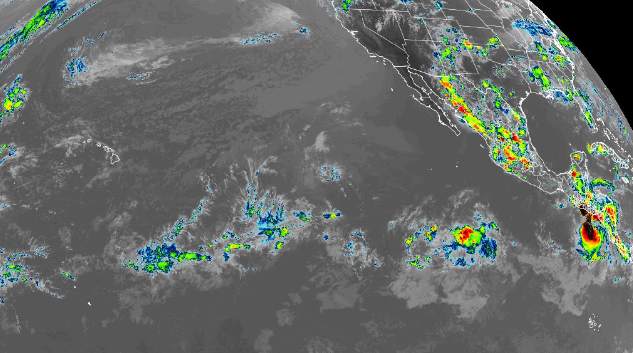
Radar data from the Nicaraguan Weather Service in Las Nubes and recent satellite imagery indicate that Bonnie has continued to become better organized throughout the day today. The well-defined center of circulation and prominent banding south and west of the storm’s center have persisted for the last several hours. Based on this improved appearance and structure, the National Hurricane Center (NHC) has nudged the intensity of the tropical storm up a bit.
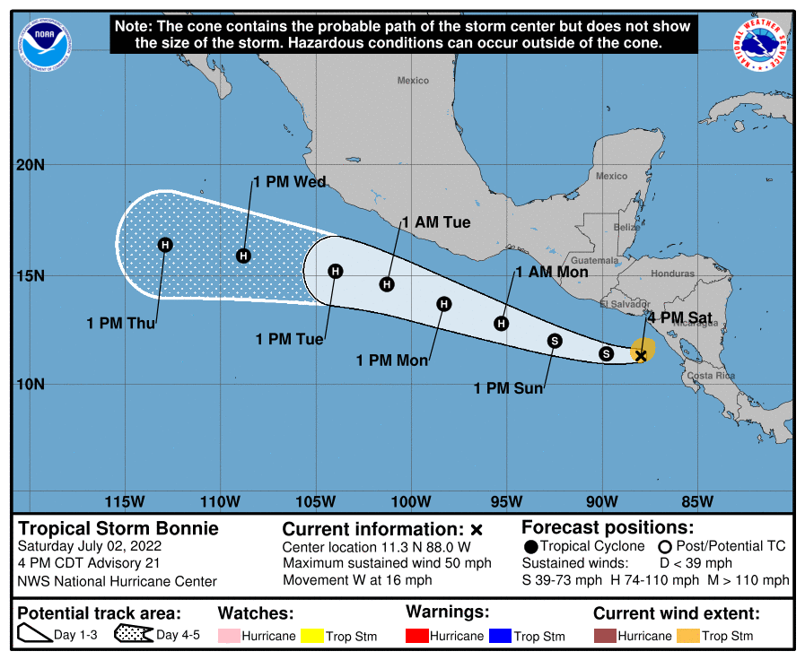
Right now, Tropical Storm Bonnie is still moving due west and the NHC says the track forecast is largely unchanged from the prior advisory. A deep-layer ridge located north of the storm will be the primary steering influence throughout the forecast period as Bonnie turns west-northwestward and is forecast to remain offshore and roughly parallel to the coast of Central America and Mexico. However, while the NHC forecast keeps the strongest winds offshore, they caution that interests in coastal El Salvador, Guatemala, and southwestern Mexico should continue to monitor Bonnie’s track for the next few days, as any northward track adjustments could require tropical storm watches for portions of this coastline.
The NHC says that some continued strengthening is expected in the next day or two as Bonnie is forecast to move over an area of warmer sea surface temperatures and relatively low vertical wind shear. For that reason, Bonnie is expected to reach hurricane strength in about two days. The NHC also points out that their intensity forecast is near the center of the guidance envelope, with some of the mesoscale hurricane models showing more rapid strengthening than the official forecast. As such, people in the Eastern Pacific should closely monitor this storm in the next few days.
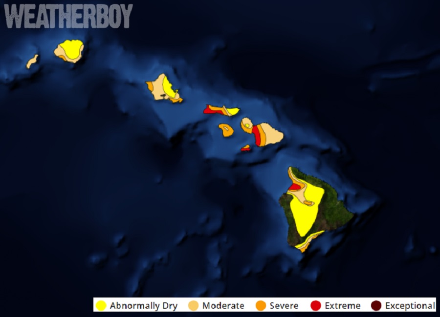
Global computer forecast models suggest the storm will eventually head west towards Hawaii. Because the Pacific is relatively colder between the coast of Mexico and the islands of Hawaii, weakening is likely and the storm system will likely lose all tropical characteristics as it moves west. However, lingering moisture from Bonnie could travel over Hawaii, bringing heavy rain to the island chain state in about 2 weeks. While a sudden surge of moisture could bring flash flooding and mud/rock slides to Hawaii, it could also bring much needed precipitation to a state suffering from a prolonged serious drought.
