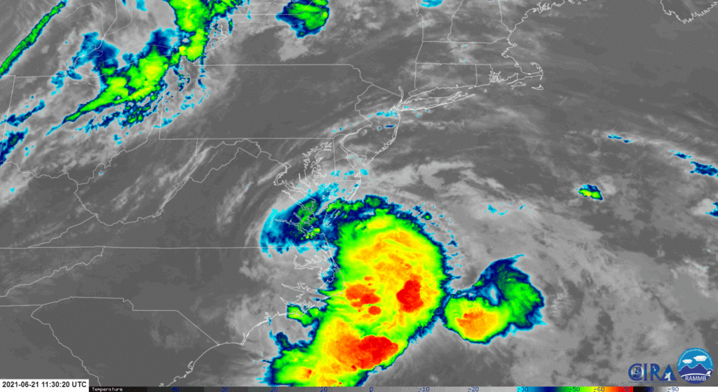
Tropical Storm Claudette continues its exit from the East Coast after bringing heavy, flooding rains to a large part of the southern and eastern United States over the last few days. With the storm departing the U.S., conditions will improve in its wake.
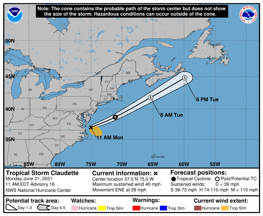
According to the last update from the National Hurricane Center (NHC) in Miami, Florida, center of Tropical Storm Claudette
was located near latitude 37.0 North, longitude 75.0 West. Claudette was moving toward the east-northeast near 28 mph. Maximum sustained winds are near 40 mph with higher gusts, making it a minimal tropical storm. The estimated minimum central pressure is 1007 mb or 29.74″.

The NHC says that an east-northeastward to northeastward motion will continue today and tomorrow with some increase in forward speed over the next day or so. On the forecast track, the system will pass just south of Nova Scotia on Tuesday. Claudette’s strong winds are currently occurring mostly over water, southeast of Claudette’s center. Some additional slight strengthening is possible over the western Atlantic Ocean today; however, Claudette is forecast to become a post-tropical cyclone Tuesday afternoon and dissipate late Tuesday night.
With the storm heading out to sea, dry conditions will return. However, the dry period will be brief: an approaching frontal system that is helping push Claudette out to sea will bring a round of showers and thunderstorms through the eastern U.S.. Once that front clears the coast, dry conditions will return.