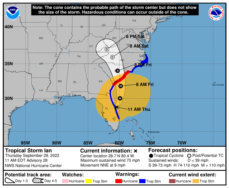
Tropical Storm Ian has crossed the Florida peninsula, impacting the southwest Gulf coast with devastating results and now exiting the Atlantic coast near the NASA Kennedy Space Center. With the storm’s center of circulation moving over warm water and into an environment temporarily favorable for intensification, Ian could get stronger and become a hurricane once again before making a final U.S. East Coast landfall.
In the National Hurricane Center’s (NHC) latest update, they now call for Ian to become a hurricane once again and strike the South Carolina Coast. Due to this updated track and intensity forecast, the NHC has issued a Hurricane Warning for the entire South Carolina Coast from Little River Inlet to the Savannah River.
Ian continues to evolve as a tropical cyclone. Maximum sustained winds have increased to near 70 mph with higher gusts. According to the NHC, Ian is expected to become a hurricane again this evening and make landfall as a hurricane on Friday, with rapid weakening forecast after landfall.
Ian is a large cyclone. Tropical-storm-force winds extend outward up to 415 miles from the center. A NOAA CMAN station at the Saint Johns County pier in Saint Augustine Beach recently reported a sustained wind of 53 mph and a gust of 61 mph. A WeatherSTEM station reported a gust of 74 mph was reported at Marineland, Florida.
The estimated minimum central pressure has dropped to 987 mb or 29.15″.
Many hazards persist with Ian; those dangers will spread up the coast.
There is a danger of life-threatening storm surge through Friday along the coasts of northeast Florida, Georgia, and South Carolina. Residents in these areas should follow any advice given by local officials.
Hurricane-force winds are expected across the South Carolina coast beginning early Friday, where a Hurricane Warning has been
issued. Hurricane conditions are possible by tonight along the coasts of northeastern Florida and Georgia, where a Hurricane Watch is in effect. Preparations should be rushed to completion since tropical-storm-force winds will begin well before the center approaches the coast.

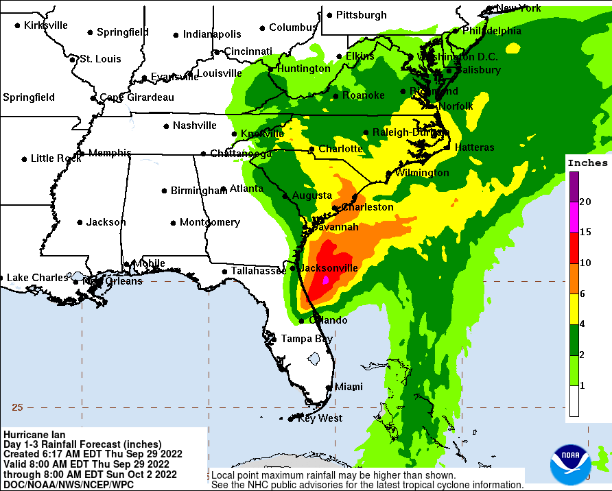
Ongoing major-to-record river flooding will continue across portions of central Florida, with considerable flooding in northern
Florida. Considerable flash and urban flooding is expected across coastal portions of northeast Florida through Friday. Local significant flooding in southeastern Georgia and eastern South Carolina is expected through the end of the week.