Tropical Storm Karl is fading away this evening after being almost entirely dissolved away earlier today near the southern Mexico coast of the Gulf of Mexico. Karl is located about 65 miles northwest of Ciudad Del Carmen, Mexico and has maximum sustained winds of 40 mph. The pressure is up to 1003 mb or 29.62″ and rising, indicative of a storm system that is falling apart.
While Karl is forecast to quickly lose the rest of its tropical cyclone characteristics, its remnant moisture is still packing a punch to those in Mexico where heavy rain, flash flooding, and rockslides are a problem.
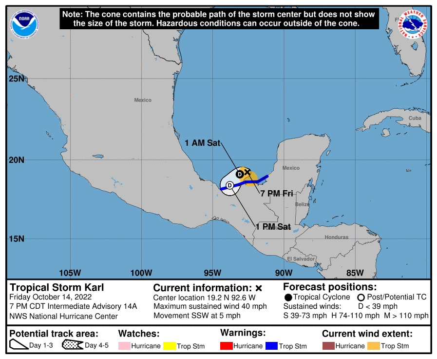
A Tropical Storm Warning remains in effect from Coatzacoalcos to Sabancuy. A Tropical Storm Warning means that tropical storm conditions are expected somewhere within the warning area, in this case within the next 12 hours.
Karl’s center is expected to drift over the Bay of Campeche tonight with the center of what’s left of its circulation on land by tomorrow morning. Karl is expected to become a tropical depression tonight or early Saturday and dissipate by early Sunday.
While the threat of strong winds decreases with each passing hour, the threat of flooding rain is growing with the center near the coast. Karl is expected to produce 2-5″ of rain, with local maxima up to 8″ possible across portions of Veracruz, Tabasco, and northern Chiapas and Oaxaca states in Mexico into early Sunday.
These rains could produce flash flooding, along with mudslides, in higher terrain.
