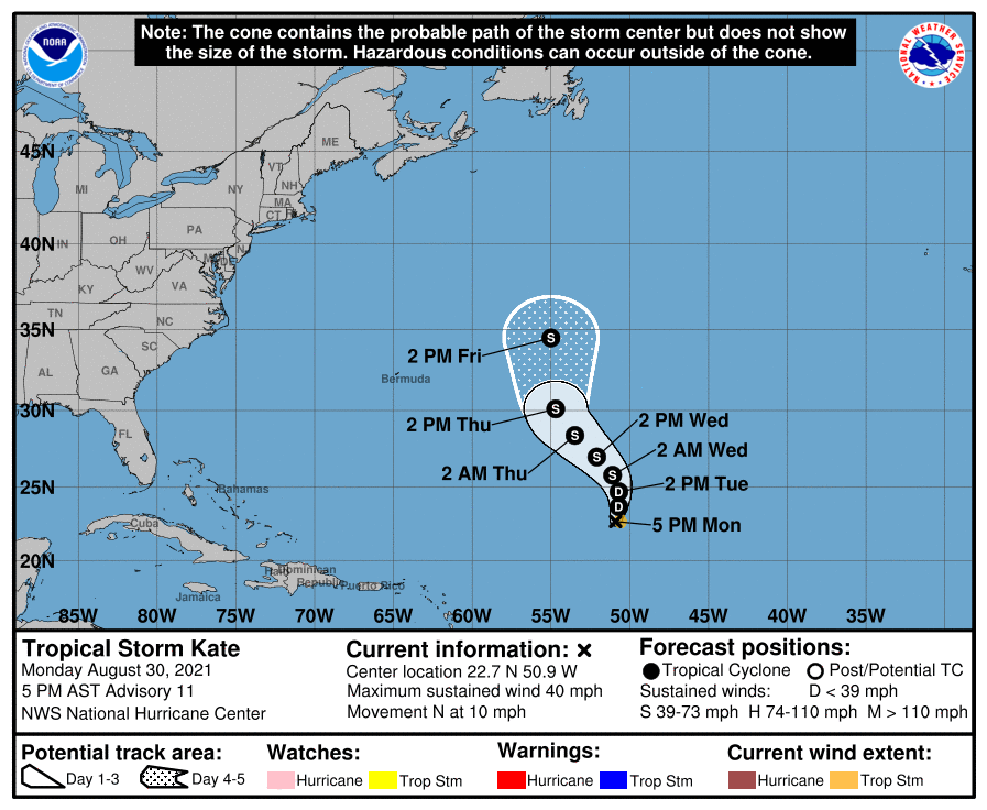
Short-lived Tropical Storm Julian which formed yesterday has dissipated; however, a brand new system has formed well south of where Julian was. Named Kate, it is the latest named storm in a very active Atlantic Hurricane Basin.
In the latest advisory from the National Hurricane Center, Kate was roughy 805 miles east-northeast of the Leeward Islands.
With maximum sustained winds of 40 mph and a barometric pressure of 1006 mb or 29.71″, Kate was moving to the north at 10 mph.
The National Hurricane Center expects Kate to keep moving north, with a slight decrease in forward speed through early Tuesday. Then, a northwestward motion is forecast through midweek. Maximum sustained winds have decreased to near 40 mph with higher gusts. Some fluctuations in intensity are forecast during the next couple of days. Some slow strengthening is possible by Thursday.
For now, Kate is expected to remain over open waters of the central North Atlantic and only threaten shipping lanes; no interactions with land are expected over the next five days.