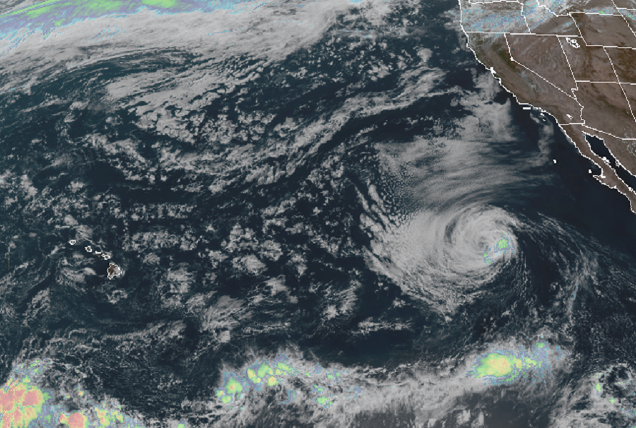
While Mother Nature is providing meteorologists with a break in the Atlantic Hurricane Basin, things are still somewhat busy in the Pacific with Tropical Storm Lowell spinning about in the open waters of the Eastern pacific between Hawaii and the Baja Peninsula of Mexico.
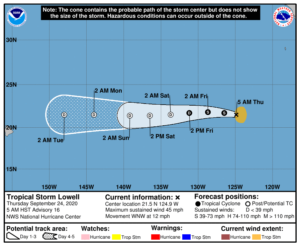
As of the latest advisory from the National Hurricane Center, Lowell was located roughly 965 miles west of the southern tip of Baja California with maximum sustained winds of 45 mph. The estimated minimum central pressure is 1003 mb or 29.62 inches.
According to the National Hurricane Center, gradual weakening of this system is forecast over time. For now, it’s moving to the west-northwest at 12 mph and a general westward motion, with a somewhat faster speed, is expected this weekend. By Saturday, Lowell should become a remnant low. While it will not impact Hawaii as a tropical cyclone, it is likely to bring some moisture to the Aloha State, especially on Maui and Hawaii Islands where heavier showers could be triggered around Tuesday.

It is possible another tropical cyclone could form in Lowell’s wake. An area of low pressure is expected to form south or southwest of the southwest coast of Mexico early next week. Some gradual development will be possible thereafter while the system moves generally west-northwestward, but any such development will take time and would likely not happen until the weekend or beyond. Some computer forecast guidance suggests this could develop into a cyclone and eventually bring Hawaii direct or indirect impacts. However, forecast guidance performance this far out is typically poor and unreliable. Nevertheless, because it is hurricane season, people in Hawaii should occasionally monitor what’s what in the tropical Pacific for any tropical cyclone threats in the future.