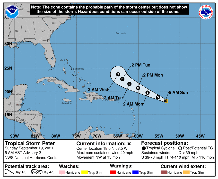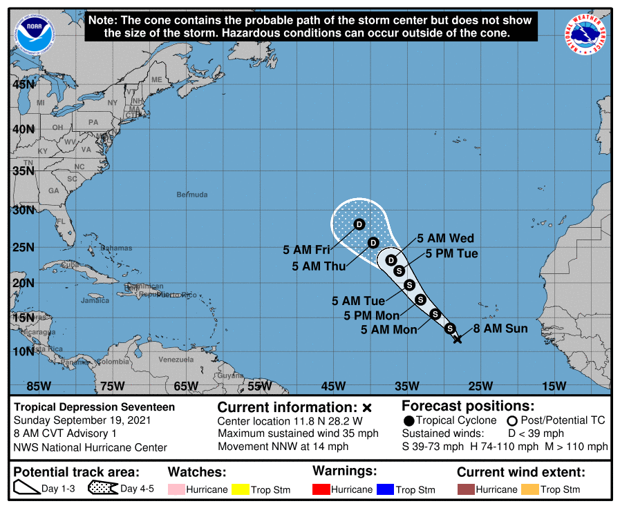
Tropical Storm Peter formed in the open waters of the Atlantic Ocean and it appears Tropical Storm Rose may not be far behind. Tropical Depression #17 formed in the far Atlantic and it is expected to develop into Rose this weekend.
As of the latest update from the National Hurricane Center (NHC) out moments ago, Peter was centered roughly 470 miles east of the northern Leeward Islands and had maximum sustained winds of 45 mph. It is currently moving to the west-northwest at 15 mph; its minimum central pressure is 1008 mb or 29.77″.
There are no watches or warnings up for this storm yet, but the NHC cautions that interests in the northern Leeward Islands, the Virgin Islands, and Puerto Rico monitor the future progress of this system.
On the current forecast track from the NHC, Peter is expected to pass well to the north of the northern Leeward Islands on Monday and Tuesday. However, rainfall from the southern periphery of Tropical Storm Peter may lead to areas of urban and small stream flooding from late Sunday into Tuesday across Puerto Rico, the Virgin Islands, and the Northern Leeward Islands.
The NHC says some additional strengthening is forecast during the next day or so, followed by a slow weakening trend by late Monday and on Tuesday. At this time, the NHC does not expect Peter to become a hurricane.

Meanwhile, the NHC expects Tropical Depression #17, the latest addition to the 2021 Atlantic Hurricane Season, to develop into Tropical Storm Rose today. Located in the far Atlantic, this system is also not expected to become a hurricane. The NHC says this storm may even weaken down to a tropical depression again by the middle of the upcoming week, degenerating over the open waters of the Atlantic between North America and Africa.