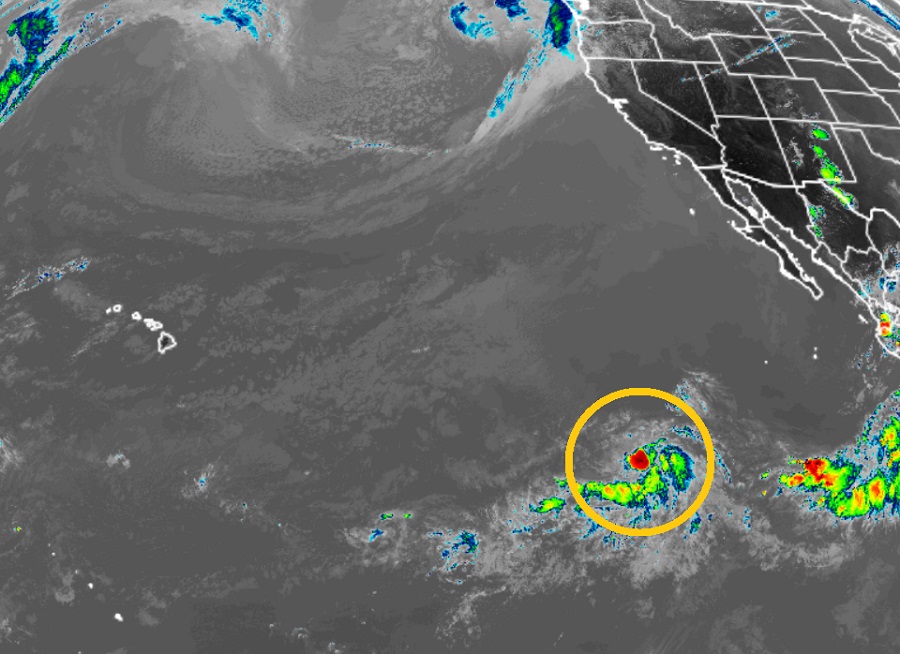
According to the National Hurricane Center (NHC) in Miami, Florida, a new disturbance has organized into another Tropical Depression in the eastern Pacific; while it is forecast to become a tropical storm, it should be no threat to Hawaii or Mexico. The NHC has designated the system as Tropical Depression Three-E.
Convection increased last night and began to consolidate, while satellite images and microwave data this morning indicated that there was evidence of a well-defined low developing. Because of this data and imagery, the NHC classified the system as the season’s next tropical depression.
The NHC says the environment surrounding the depression is moderately conducive for gradual strengthening. Sea surface temperatures support additional development, it is in a humid air mass, and vertical wind shear is light. Because these favorable conditions should linger for the next 2-3 days, additional intensification is forecast. However, in about 3-4 days, dry air and subsidence are expected to hinder any further intensification and the system should begin a weakening trend then.
Based on this outlook, the tropical depression should become a tropical storm overnight tonight and weaken back to a tropical depression or less in about 4-5 days.
The system is expected to spin about over open waters of the Pacific, well to the east of Hawaii and well to the west of Mexico. As such, no threats to land are expected, especially with the system forecast to weaken in 3-4 days.